This article was originally published in the Gasconade County Republican on Wednesday, August 31.
By Dave Marner
Plans for a “learning festival” based along, and on the Missouri River, for county high school and middle school students are being finalized as Missouri River Relief prepares to celebrate its 10th anniversary of cleaning the “Big Muddy.”
Students from Owensville High School, Owensville Middle School, the Hermann school district, and St. George, have been invited to attend separate day-long programs based on shore and on the Living Lands and Waters garbage barge River Relief will be using as the group travels down river from Jefferson City to St. Charles during October. Missouri River Relief is a Missouri Stream Team member based in Columbia, Mo., which has conducted large-scale cleanups from Yankton, S.D, to the mouth of the Missouri where it meets the Mississippi River. Students and faculty chaperones will have the chance to participate in several stations of land-based educational programs presented by professionals from the various agencies assisting River Relief staff.
Staff from the Gasconade and Montgomery County Soil and Water Conservation Districts, the Natural Resources Conservation Service, the Missouri Department of Conservation, and the Farm Service Agency are scheduled to be participating in the program.
With river levels expected to drop over the next month, River Relief is also planning to have water-based learning stations which could include instruction on aquatics, biology, and water quality issues.
School administrators discussed curriculum issues with Barrow and the agency representatives planning to participate in an effort to design learning experiences which will match up with each school’s educational programs.
“This is exciting,” said Barrow who was making his second planning trip to Owensville for the project. He also met last Thursday with school officials in Hermann. “I’m really excited.”
“Our teachers are really looking forward to this,” said Kurt Keller, principal at OHS.
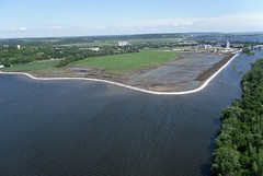
Part of the experience will include the chance for students to help clean a section of the river’s shoreline under the supervision of trained MRR personnel. That aspect of the experience was something Teresa Ragan, principal at OMS, would strongly support. “Service learning gives something back to the community,” said Ragan.
OHS students are scheduled to attend the festival on Tuesday, Oct. 4, OMS attends Wednesday, Oct. 5, and Hermann students are invited on Thursday, Oct. 6.
Showing posts with label Missouri. Show all posts
Showing posts with label Missouri. Show all posts
Wednesday, August 31, 2011
Thursday, July 28, 2011
Corps emails released; drought eases flooding
For the thousands of people affected by this flood who have been wondering how the Corps of Engineers was dealing with water releases as snow piled up this spring, followed by massive rains in the upper basin, the Sioux Falls Argus-Leader opened a window this week. Through a Freedom of Information request, the AL obtained a batch of Corps emails documenting the evolution of this flood. Check out the stories below giving context to this trove of information.
For communities, highway departments and levee districts trying to plan for a fall of repairs, this Friday will provide a guide to future river levels. The Corps is planning on releasing their dam release schedules through September on this Friday, July 29. As always, the forecasts will be subject to change depending on rainfall in the basin. The Corps is planning on reducing Gavin's Point Dam releases from 160,000 cfs to 150,000 from July 31 to August 2.
Although pulses of rain in the Big Sioux River basin caused new flood crests from Sioux City to Kansas City, the whole lower basin has been spared from the worst case scenario by little to no rain in many parts of the basin. In some counties, farmers in the uplands are suffering the beginning of drought while bottomland farmers are monitoring their levees and constantly pumping out seepwater. At the same time, the continuous massive flows continue to test levees and flood prevention measures throughout the basin.
Argus-Leader series on Corps of Engineers emails
The Sioux Falls Argus-Leader obtained a block of emails from late winter/spring 2011 that give a window into the reservoir releases as weather deteriorated this spring. Includes an analysis story with links to raw emails as well as a timeline created from information in the emails.
The Corps of Engineers Kansas City District has been releasing aerial recon photos in Google Earth format. If you have Google Earth installed on your computer, you can click the links below to download .kmz files that will open in Google Earth.
Click here to view aerial photos posted by Google of areas near Council Bluffs, IA.
Editorial/Analysis
Leavenworth Times, July 26, 2011 - "The Missouri River Canal" by Matt Nowak - an idea to send Missouri River water to drier parts of the country. Nothing like a flood to make people forget the drought we just came out of.
St. Louis Post Dispatch, July 22, 2011 - "The Missouri River Compromise" by Robert Kelley Schneiders . You can also check out Schneiders' flood blog by clicking here.
Dakotas
Keloland TV, July 24, 2011 - "No Flood Assistance from FEMA" for individual homeowners.
Yankton Press-Dakotan, July 26, 2011 - "Corps Ready to Reveal Long-term Water Plans" - The Corps will announce release schedule through Sept. on Friday, July 28.
Bismarck Tribune, July 26, 2011 - "Gov. Dalrymple says Corps must give answers"
Pierre Capital Journal, July 27, 2011 - "State sets up flood camage call center" - in an attempt to appeal FEMA's decision to withhold assistance for individual homeowners, the state is attempting to collect more information on flood damage to present to FEMA.
Nebraska/Iowa
KTIV Channel 4 - July 27, 2011 - "Missouri River bed drops 6-8 feet"
Omaha World-Herald, July 25, 2011 - "River dropping after second crest"
Omaha World-Herald, July 27, 2011 - "Plans laid for I-29 reopening" - Waters still have a lot of receding to do, and damage to many areas is unknown, but plans are being made for action after waters drop.
Omaha World-Herald, July 22, 2011 - "Below Flood stage by September?"
WOWT-channel 6, July 24, 2011 - "Aerial Tour of flooding"
WOWT-channel 6, July 25, 2011 - "River Pests out in force"
Businessweek, July 27, 2011 - "Nebraska nuclear plant's flood recovery being planned"
Kansas/Missouri
FOX Channel 4 - July 26, 2011 - "Flooding still threatens Holt County levees"
St. Joseph News-Press, July 27, 2011 - "Casino may not reopen until October"
St. Joseph News-Press, July 24, 2011 - "Trials and tribulations of a long summer"
St. Joseph News-Press, July 25, 2011 - "Flood insurance policies lead to frustration"
Columbia Missourian, July 23, 2011 - "Missouri River flooding hurts barge industry"
KSU Collegian, July 24, 2011 - "Kansas River race fills void after Missouri River flooding"
Columbia Tribune, July 24, 2011 - "Nixon says state ready to help Wooldridge"
Columbia Tribune, July 24, 2011 - "Corps faces a battle over land near Wilton"
For communities, highway departments and levee districts trying to plan for a fall of repairs, this Friday will provide a guide to future river levels. The Corps is planning on releasing their dam release schedules through September on this Friday, July 29. As always, the forecasts will be subject to change depending on rainfall in the basin. The Corps is planning on reducing Gavin's Point Dam releases from 160,000 cfs to 150,000 from July 31 to August 2.
Although pulses of rain in the Big Sioux River basin caused new flood crests from Sioux City to Kansas City, the whole lower basin has been spared from the worst case scenario by little to no rain in many parts of the basin. In some counties, farmers in the uplands are suffering the beginning of drought while bottomland farmers are monitoring their levees and constantly pumping out seepwater. At the same time, the continuous massive flows continue to test levees and flood prevention measures throughout the basin.
Argus-Leader series on Corps of Engineers emails
The Sioux Falls Argus-Leader obtained a block of emails from late winter/spring 2011 that give a window into the reservoir releases as weather deteriorated this spring. Includes an analysis story with links to raw emails as well as a timeline created from information in the emails.
- Sioux Falls Argus-Leader - July 24, 2011 - "Corps Alerted to Coming Flood" - Analysis and raw email files
- Sioux Falls Argus-Leader - July 24, 2011 - "Excerpts of Corps Email Traffic" - a timeline of flood evolution based on Corps emails.
The Corps of Engineers Kansas City District has been releasing aerial recon photos in Google Earth format. If you have Google Earth installed on your computer, you can click the links below to download .kmz files that will open in Google Earth.
- July 21, North of Kansas City
- July 21, East of Kansas City
- Direct link to Kansas City District Flood page
- Kansas City District Flickr Photo files (see photo sets on right to view latest aerial recon photos)
Click here to view aerial photos posted by Google of areas near Council Bluffs, IA.
Editorial/Analysis
Leavenworth Times, July 26, 2011 - "The Missouri River Canal" by Matt Nowak - an idea to send Missouri River water to drier parts of the country. Nothing like a flood to make people forget the drought we just came out of.
St. Louis Post Dispatch, July 22, 2011 - "The Missouri River Compromise" by Robert Kelley Schneiders . You can also check out Schneiders' flood blog by clicking here.
Dakotas
Keloland TV, July 24, 2011 - "No Flood Assistance from FEMA" for individual homeowners.
Yankton Press-Dakotan, July 26, 2011 - "Corps Ready to Reveal Long-term Water Plans" - The Corps will announce release schedule through Sept. on Friday, July 28.
Bismarck Tribune, July 26, 2011 - "Gov. Dalrymple says Corps must give answers"
Pierre Capital Journal, July 27, 2011 - "State sets up flood camage call center" - in an attempt to appeal FEMA's decision to withhold assistance for individual homeowners, the state is attempting to collect more information on flood damage to present to FEMA.
Nebraska/Iowa
KTIV Channel 4 - July 27, 2011 - "Missouri River bed drops 6-8 feet"
Omaha World-Herald, July 25, 2011 - "River dropping after second crest"
Omaha World-Herald, July 27, 2011 - "Plans laid for I-29 reopening" - Waters still have a lot of receding to do, and damage to many areas is unknown, but plans are being made for action after waters drop.
Omaha World-Herald, July 22, 2011 - "Below Flood stage by September?"
WOWT-channel 6, July 24, 2011 - "Aerial Tour of flooding"
WOWT-channel 6, July 25, 2011 - "River Pests out in force"
Businessweek, July 27, 2011 - "Nebraska nuclear plant's flood recovery being planned"
Kansas/Missouri
FOX Channel 4 - July 26, 2011 - "Flooding still threatens Holt County levees"
St. Joseph News-Press, July 27, 2011 - "Casino may not reopen until October"
St. Joseph News-Press, July 24, 2011 - "Trials and tribulations of a long summer"
St. Joseph News-Press, July 25, 2011 - "Flood insurance policies lead to frustration"
Columbia Missourian, July 23, 2011 - "Missouri River flooding hurts barge industry"
KSU Collegian, July 24, 2011 - "Kansas River race fills void after Missouri River flooding"
Columbia Tribune, July 24, 2011 - "Nixon says state ready to help Wooldridge"
Columbia Tribune, July 24, 2011 - "Corps faces a battle over land near Wilton"
Thursday, July 21, 2011
Long term flood continues to reveal damages
The Omaha World Herald today says..."50 days of flooding and counting". And, although the Corps will be lowering releases from Gavin's Point Dam from 160 kcfs to 150 kcfs at the end of July, baseline levels will remain high at least through mid-August. Latest Corps predictions show 150kcfs releases continuing at least until August 12. The Corps says that because of water draining from adjacent floodplains, there will be no noticeable drop even with this reduction in releases.
Relatively dry weather in the lower basin, with most rain events being sporadic and scattered has meant that levels have retreated from their highs but remain fairly level. However, rain in the Big Sioux River watershed pushed levels to a probable record in Sioux City today. The focus for most flood fighting has been shoring up soggy levees, attacking sand boils, pumping seepage from behind protected areas and basic pump maintenance. Sandbags continue to be filled in many areas, applied to new trouble spots.
Confusion with flood insurance has led to some new legislation changing some of FEMA's rules and the Corps and FEMA have begun collecting flood damage claims. The process will prove to be long and frustration for the many people damaged in the flood. Many counties affected have not received federal major disaster declaration from the President.
As flooding continues, inundated houses have been collapsing, new channels appear to be forming, mold is spreading and mosquitoes have been relentless. The oppressive heat has made all flood fighting more dangerous and exhausting. Some residents have just recently been able to view their flooded homes in rural areas shut down from access, and have been shocked at the damage. The Decatur bridge is experiencing undermining of its approach ramps and highways still under water have an undetermined amount of erosion and saturation damage. The Corps continues to check their dams, release tunnels and spillways for erosive damage. They continue to assure that dams are operating as designed.
Officials worry that the good news of drawdowns by the Corps might catch people off guard if there is rain later. Unlike many flood events, there is no real predicted "crest". Additional rain will continue to cause spikes in river levels that will need to be watched. As many of the stories below reveal, people and businesses continue to suffer, and are still unable to know just how much they've been effected by this prolonged flood.
Here's some links to news stories published on the web about how communities are coping with the flood.
Aerial Photography
The Corps has opened two different processes for levee districts or individuals filing either claims on damages to property or to request assistance in levee rehabilitation. Here's a couple links
Billings Gazette - July 21, 2011 - "Buffalo Bill Reservoir Fills"
Billings Gazette - July 10, 2011 - "Hell & High Water - Fort Peck Marina owner battered by flooding"
Dakotas
Bismarck Tribune - July 21, 2011 - "Bismarck asks residents to limit water use" Sediment both suspended in the water and piling up at the water plant intake has lowered the water plant capacity.
Bismarck Tribune - July 20, 2011 - "Flood victim turns heartbreak into poetry" With great video as well.
Bismarck Tribune - July 19, 2011 - "Corps discusses this year's releases, next year's plans"
& "Regulatory tunnels holding up at Garrison Dam"
Bismarck Tribune - July 15, 2011 - "Oil spill hits the Missouri River south of Williston"
CNN - July 12, 2011 - "How long will Missouri mega-flood endure"
Nebraska/Iowa
KCAU - TV9 - July 19, 2011 - "WinnaVegas Casino to reopen thanks to amphibious duck boats"
& "Dam Debris Piling Up"
Omaha World-Herald - July 21, 2011 - "50 days of flooding and counting"
Omaha World- Herald - July 19, 2011 - "Fighting flood is a daily battle"
Washington County Pilot-Tribune and Enterprise (Blair/Fort Calhoun Area) - "Nobody told us it was going to be this bad" & "Glimpse of Damage from Flooding" & "Still a lot of confusion about flood insurance" & "Disaster plea includes individual assistance" & "Farmers play waiting game with flood"
WOWT Channel 6, Omaha - July 14, 2011 - "What will be left when the flood recedes?"
Sioux City Journal - July 14, 2011 - "Conditions improve at Nebraska nuclear plants"
Radio Iowa - July 21, 2011 - "Missouri River trouble coalition proposal gaining momentum" An effort to bring states together to address Missouri River management
KMEG 14 - July 20, 2011 - "Dealing with mold after the water recedes"
KCAU - July 13, 2011 - "Social Media Helps people stay current on flood information"
Omaha World-Herald - July 12, 2011 - "Flood forces creative commuting"
Omaha World-Herald - July 12, 2011 - House OK's flood insurance bill"
Missouri/Kansas
Maryville Daily Forum - July 21, 2011 - "Holt County Organizing Flood Claims Effort"
St. Joseph News-Press, July 20, 2011 - "Up close it's pretty devastating - Officials must wait to begin flood cleanup"
Kansas City Star, July 12, 2011 - "Farmland in Carroll County covered with floodwaters"
Missouri National Guard Blog - July 12, 2011 - "Guardsmen rescue family from flooding home"
St. Louis Post-Dispatch - July 12, 2011 - "McCaskill, Blunt say Missouri River summit aims to get beyond old battles"
St. Louis Post-Dispatch - July 13, 2011 - "Federal Flood Insurance confuses many along Missouri River basin"
Relatively dry weather in the lower basin, with most rain events being sporadic and scattered has meant that levels have retreated from their highs but remain fairly level. However, rain in the Big Sioux River watershed pushed levels to a probable record in Sioux City today. The focus for most flood fighting has been shoring up soggy levees, attacking sand boils, pumping seepage from behind protected areas and basic pump maintenance. Sandbags continue to be filled in many areas, applied to new trouble spots.
Confusion with flood insurance has led to some new legislation changing some of FEMA's rules and the Corps and FEMA have begun collecting flood damage claims. The process will prove to be long and frustration for the many people damaged in the flood. Many counties affected have not received federal major disaster declaration from the President.
As flooding continues, inundated houses have been collapsing, new channels appear to be forming, mold is spreading and mosquitoes have been relentless. The oppressive heat has made all flood fighting more dangerous and exhausting. Some residents have just recently been able to view their flooded homes in rural areas shut down from access, and have been shocked at the damage. The Decatur bridge is experiencing undermining of its approach ramps and highways still under water have an undetermined amount of erosion and saturation damage. The Corps continues to check their dams, release tunnels and spillways for erosive damage. They continue to assure that dams are operating as designed.
Officials worry that the good news of drawdowns by the Corps might catch people off guard if there is rain later. Unlike many flood events, there is no real predicted "crest". Additional rain will continue to cause spikes in river levels that will need to be watched. As many of the stories below reveal, people and businesses continue to suffer, and are still unable to know just how much they've been effected by this prolonged flood.
Here's some links to news stories published on the web about how communities are coping with the flood.
Aerial Photography
- From Lee Valley Auctions - Missouri River Flooding 2011
- Omaha World Herald -July 15, 2011
- Earth Observatory - Map links to archive of satellite photos of Missouri River flooding
- Photos by John Dame - a set of photos starting June 17, ending July 15
- Iowa State Patrol - a series of flood photos
- Sioux City Journal - July 17. 2011 - "Water Storage Question must be answered" A letter to the editor laying out the crucial question - how much room should be left in dams at end of winter.
- Sioux City Journal - July 17, 2011 - "Let the Missouri River be a river"
- Robert Kelley Schneiders ongoing blog on Missouri River flooding (Schneiders is author of "Unruly River" a history of change on the Missouri River)
- MSNBC - July 12, 2011 - "Some say environmental groups share flooding blame"
- From the office of US Rep. for Missouri Blaine Luetkemeyer - Press Release July 15, 2011 - "Luetkemeyer River Amendments Protect Missouri Taxpayers and Communities"
- Editorial by Dave Helling, - July 15, 2011 - "Missouri's politicians voted to kill river study similar to the one they now seek" & Helling's piece published in KC Star - July 12, 2011 - "Drive to better manage river on-again, off-again"
The Corps has opened two different processes for levee districts or individuals filing either claims on damages to property or to request assistance in levee rehabilitation. Here's a couple links
- "Filing a claim for damages..." The Corps is not promising payments for damages, but has begun a process for people to begin filing claims. This is the Omaha District.
- Resources for levee rehabilitation or alternatives to rehabilitation. Kansas City District.
Billings Gazette - July 21, 2011 - "Buffalo Bill Reservoir Fills"
Billings Gazette - July 10, 2011 - "Hell & High Water - Fort Peck Marina owner battered by flooding"
Dakotas
Bismarck Tribune - July 21, 2011 - "Bismarck asks residents to limit water use" Sediment both suspended in the water and piling up at the water plant intake has lowered the water plant capacity.
Bismarck Tribune - July 20, 2011 - "Flood victim turns heartbreak into poetry" With great video as well.
Bismarck Tribune - July 19, 2011 - "Corps discusses this year's releases, next year's plans"
& "Regulatory tunnels holding up at Garrison Dam"
Bismarck Tribune - July 15, 2011 - "Oil spill hits the Missouri River south of Williston"
CNN - July 12, 2011 - "How long will Missouri mega-flood endure"
Nebraska/Iowa
KCAU - TV9 - July 19, 2011 - "WinnaVegas Casino to reopen thanks to amphibious duck boats"
& "Dam Debris Piling Up"
Omaha World-Herald - July 21, 2011 - "50 days of flooding and counting"
Omaha World- Herald - July 19, 2011 - "Fighting flood is a daily battle"
Washington County Pilot-Tribune and Enterprise (Blair/Fort Calhoun Area) - "Nobody told us it was going to be this bad" & "Glimpse of Damage from Flooding" & "Still a lot of confusion about flood insurance" & "Disaster plea includes individual assistance" & "Farmers play waiting game with flood"
WOWT Channel 6, Omaha - July 14, 2011 - "What will be left when the flood recedes?"
Sioux City Journal - July 14, 2011 - "Conditions improve at Nebraska nuclear plants"
Radio Iowa - July 21, 2011 - "Missouri River trouble coalition proposal gaining momentum" An effort to bring states together to address Missouri River management
KMEG 14 - July 20, 2011 - "Dealing with mold after the water recedes"
KCAU - July 13, 2011 - "Social Media Helps people stay current on flood information"
Omaha World-Herald - July 12, 2011 - "Flood forces creative commuting"
Omaha World-Herald - July 12, 2011 - House OK's flood insurance bill"
Missouri/Kansas
Maryville Daily Forum - July 21, 2011 - "Holt County Organizing Flood Claims Effort"
St. Joseph News-Press, July 20, 2011 - "Up close it's pretty devastating - Officials must wait to begin flood cleanup"
Kansas City Star, July 12, 2011 - "Farmland in Carroll County covered with floodwaters"
Missouri National Guard Blog - July 12, 2011 - "Guardsmen rescue family from flooding home"
St. Louis Post-Dispatch - July 12, 2011 - "McCaskill, Blunt say Missouri River summit aims to get beyond old battles"
St. Louis Post-Dispatch - July 13, 2011 - "Federal Flood Insurance confuses many along Missouri River basin"
Monday, July 11, 2011
Updated forecast on Gavin's releases - river now closed upstream of Glasgow
Two little pieces of just released news, and some more details on levees and the threat to US65:
1. The Corps has released more details on their forecast for Gavin's Point releases. On July 30, releases will be reduced from 160,000 cfs to 155,000. On August 1, they will be reduced to 150,000. Heavy rains could still affect this forecast.
2. The Coast Guard has extended the closure of the Missouri River to all traffic from the Gavin's Point Dam to the Glasgow bridge at river mile 226.3.
3. Snowpack continues to melt. Here's the latest: The snow above Fort Peck peaked at 141% of normal and is now down to 6% of normal. The snow in the reach between Fort Peck and Garrison (primarily the Yellowstone basin) peaked at 136% and is now down to 4%. The snow in the North Plate basin pecked at 150% of Normal and is currently down to less than 10% and the snow pack in the South Platte Basin peaked at 150% of Normal and the melting in this reach is complete.
4. From Tom Waters of the Missouri Levee & Drainage District Assoc.: The Root Levee breached early this morning. This levee is located in Southern Carroll County in Missouri. The breach is 250-33 feet long. The levee is part of a system of levees, which includes the following levees: Wakenda Levee, Sambo Slough Levee, and the Farmers Levee. Combined this system protects around 22,000 acres and US Highway 65 south of Carrollton, Missouri.
Missouri River Communities Adjust to the "New Normal": High Water, Soggy Levees and Jitters with Each Rain
blogmaster's note: It's been over a week since I published a compilation of links here. I apologize for the lull. -steve
At most gages on the river, except a few just downstream of Kansas City, river levels are dropping or remaining steady. Flood fighting continues at many locations along the river, and attention in many areas is shifting to watching soggy levees and keeping an eye on the weather forecast. Unlike many flood events, a "crest" in the river doesn't mean that a particular location is out of danger from this flood. Consistent or widespread rain can still cause local or downstream river rises while the peak flows continue from the dams. The Corps continues to say that releases from Gavin's Point Dam will remain at 160,000 cfs "well into August". Any heavy rain events in the upper basin could change this.
According to the Missouri Levee & Drainage Improvement Association, all non-federal primary levees north of Kansas City are overtopped or breached. A major levee in Carroll County, MO, downstream of Kansas City, which protects over ten thousand acres of farmland, is overtopping and residents are fighting the river with massive sandbags (click here for an map of the levee system). The "crest" here has broken the record set in 1993.
MODOT is watching US 65 in Carroll County very closely. Levee problems in that area may eventually close this highway and the bridge between Carrollton and Waverly. Current US 65 has one lane open. 9,000 feet of large sand bags have been placed along the highway to try to keep it open.
Politicians from all affected states are beginning their jockeying to protect their perceived interests as some attention shifts to re-evaluating the management of the river even as the flood continues. While journalists and other stakeholders seem to be looking for a fresh perspective, several politicians seem to be lining up along the familiar upper vs. lower state lines. See articles below for some of the analysis from a variety of newspaper and political sources.
Here's a compilation of recent links regarding the continued Missouri River flood.
News Sources
(see previous posts for more excellent links to facebook pages and news feeds on the ongoing flood)
MightyMoRiver Gazette - a newspaper style collection of flood news feeds
Newspaper Special Sections
Many major papers along the river have created landing pages for the latest on local flood news, photos and videos. Here's a few:
Omaha World-Herald, July 11, 2011 - "USGS notes flood's quirks"
Columbia Tribune, July5, 2011 - "Scientist Questions Flood Benefits of Public Land Along Missouri River" USGS fluvial geomorphologist Robb Jacobson leads study on flood retention potential of public lands in the floodplain.
Associated Press, July 9, 2011 - "Experts Expect More Missouri River Levee Failures"
Aerial Photography & Video
St. Louis Beacon, July 11, 2011 - "Flood expert Galloway: Missouri River needs comprehensive plan" Former Army Brigadier General Gerald Galloway again brings up ideas promoted in a report he helped write post-1993 flood on reducing flood risk. Click here to download 1994 report, "Sharing the Challenge".
St. Louis Post-Dispatch, July 2011 - "One River, One Problem" - a series of editorials and discussions on Missouri River management. The series was inspired by a P-D editorial with that title written in 1944 (the year of the Flood Control Act passed by Congress that implemented the Pick-Sloan Plan creating the reservoir system/navigation channel. Click here to read a reprint of the 1944 editorial.
Columbia Tribune, July 10, 2011 - "Wild Weather Wrecks Havoc on Corps' Plans" - a pretty balanced look at the different variables contributing to this flood.
Bismark Tribune, July 9, 2011 - "Making Peace with the Missouri River"
Sioux City Journal, July 9, 2011 - "Tragedy Aside - Flood will benefit knowledge of Missouri River"
Marshall Democrat-News, July 5, 2011 - "Flood of 2011 illuminates question of priorities"
Missouri River Politics
St. Joseph News-Press, July 11, 2011 - "Graves’ amendment points out ‘absurdity’- Corps spends millions more on wildlife than on levees"
St. Louis Post-Dispatch, July 10, 2011 - "Senators to Meet Over Future of Missouri River"
Missouri.net, July 7, 2011 - "Time To Study Levee Districts and the Missouri River Basin?" (audio) State of Missouri Agriculture Director calls for study of levee system.
Associated Press, July 8, 2011 - "Ag Secretary Questions Corps on Missouri River Flooding"
Omaha World-Herald, July 8, 2011 - "Branstead Criticizes River Group"
Columbia Tribune, July 6, 2011 - "McCaskill calls Corps inquiries seeking property along Missouri River insenstitive" Also - Tribune publisher Hank Waters writes a response editorial: "Claire and the Corps - Politics or Bad Performance?"
Montana
Billings Gazette, July 11, 2011 - "A Tour of Fort Peck Dam: An Engineering Marvel Holds Back Massive Missouri River"
Billings Gazette, July 11, 2011 - "Oil Spill Cleanup continues on Yellowstone River"
Time Blog, July 11, 2011 - "Why Yellowstone Oil Spill So Difficult to Clean Up"
Dakotas
Yankton Press-Dakotan, July 8, 2011 - "Dams Burdened by Rain"
Sioux City Journal, July 11, 2011 - "Some Along Missouri Wonder Why they Received no Levees"
Jamestown Sun, July 8, 2011 - "Officials need to be ready when river returns to "normal""
Omaha World-Herald, July 9, 2011 - "Reservoirs Gain a Little Room"
Iowa/Nebraska
Omaha World-Herald - July 11, 2011 - "Unwelcome News for Displaced"
KTIV - Channel 4, Sioux City - July 10, 2011 - "Sandbags fighting more than water" - Sun degradation is yet another force working against temporary flood protection.
Associated Press, July 5, 2011 - "Congested Missouri River Threatens Tributaries"
Omaha World-Herald - July 8, 2011 - "More Omahans Get Flood Warnings"
KETV Channel 7, Omaha - July 6, 2011 - "Aid could come slowly for flood Victims"
Omaha World Herald - July 7, 2011 - "Blasting of Levee OK with Branstad"
Kansas/Missouri
KMZU - 100.7 Carrollton, MO - July 11, 2011 - "Wakenda Levee Breaks"
Marshall Democrat-News - July 9, 2011 (Updated July 11) - "Private Levee Overtops in Malta Bend Bottoms"
Missouri.net, July 7, 2011 - "Missouri Levee Association Chair Provides Latest Flood Info" (audio story)
St. Joseph News-Press, July 6, 2011 - "Flood Fest 2011 to raise funds for relief"
Kansas City Star, July 8, 2011 - "Missouri River overtops Carroll County Levee"
Pulaski County News, July 8, 2011 - "Missouri National Guard conducts anti-flood operations in Cooper County in Wooldridge, MO"
At most gages on the river, except a few just downstream of Kansas City, river levels are dropping or remaining steady. Flood fighting continues at many locations along the river, and attention in many areas is shifting to watching soggy levees and keeping an eye on the weather forecast. Unlike many flood events, a "crest" in the river doesn't mean that a particular location is out of danger from this flood. Consistent or widespread rain can still cause local or downstream river rises while the peak flows continue from the dams. The Corps continues to say that releases from Gavin's Point Dam will remain at 160,000 cfs "well into August". Any heavy rain events in the upper basin could change this.
According to the Missouri Levee & Drainage Improvement Association, all non-federal primary levees north of Kansas City are overtopped or breached. A major levee in Carroll County, MO, downstream of Kansas City, which protects over ten thousand acres of farmland, is overtopping and residents are fighting the river with massive sandbags (click here for an map of the levee system). The "crest" here has broken the record set in 1993.
MODOT is watching US 65 in Carroll County very closely. Levee problems in that area may eventually close this highway and the bridge between Carrollton and Waverly. Current US 65 has one lane open. 9,000 feet of large sand bags have been placed along the highway to try to keep it open.
Politicians from all affected states are beginning their jockeying to protect their perceived interests as some attention shifts to re-evaluating the management of the river even as the flood continues. While journalists and other stakeholders seem to be looking for a fresh perspective, several politicians seem to be lining up along the familiar upper vs. lower state lines. See articles below for some of the analysis from a variety of newspaper and political sources.
Here's a compilation of recent links regarding the continued Missouri River flood.
News Sources
(see previous posts for more excellent links to facebook pages and news feeds on the ongoing flood)
MightyMoRiver Gazette - a newspaper style collection of flood news feeds
Newspaper Special Sections
Many major papers along the river have created landing pages for the latest on local flood news, photos and videos. Here's a few:
- Bismarck Tribune - Bismarck/Mandan, North Dakota
- Capital Journal - Pierre, South Dakota
- Yankton Daily Press-Dakotan - Yankton, South Dakota
- Sioux City Journal - Sioux City, Iowa
- Omaha World-Herald - Omaha, NE/Council Bluffs, IA - The most comprehensive of the Special Sections
- St. Joseph News-Press - St. Joseph, MO
- Kansas City Star - Does not have a special section
- Columbia Missourian - Columbia, MO
- St. Louis Post-Dispatch - St. Louis, MO - Their page is called One River, One Problem. It also has a Facebook Page . In addition to posting news stories from the flood, this page is focused on discussions about changing the management of the Missouri River (see below).
Omaha World-Herald, July 11, 2011 - "USGS notes flood's quirks"
Columbia Tribune, July5, 2011 - "Scientist Questions Flood Benefits of Public Land Along Missouri River" USGS fluvial geomorphologist Robb Jacobson leads study on flood retention potential of public lands in the floodplain.
Associated Press, July 9, 2011 - "Experts Expect More Missouri River Levee Failures"
Aerial Photography & Video
- Lee Valley Auction - This pilot, whose farm has flooded, has been doing almost daily flights to keep neighbors informed of conditions north of Omaha. Click here.
- KPTM - Channel 42, Omaha
- Nasa.com - Satellite view of Omaha area - ALSO - Comparison of satellite photos from June 26 and July 4 of Lower Missouri River flooding. ALSO - Comparison of satellite photos from 2010 and July 10, 2011 of Missouri stretch of the river.
- KETV Channel 7 - Omaha - Aerial photos submitted by viewers.
St. Louis Beacon, July 11, 2011 - "Flood expert Galloway: Missouri River needs comprehensive plan" Former Army Brigadier General Gerald Galloway again brings up ideas promoted in a report he helped write post-1993 flood on reducing flood risk. Click here to download 1994 report, "Sharing the Challenge".
St. Louis Post-Dispatch, July 2011 - "One River, One Problem" - a series of editorials and discussions on Missouri River management. The series was inspired by a P-D editorial with that title written in 1944 (the year of the Flood Control Act passed by Congress that implemented the Pick-Sloan Plan creating the reservoir system/navigation channel. Click here to read a reprint of the 1944 editorial.
Columbia Tribune, July 10, 2011 - "Wild Weather Wrecks Havoc on Corps' Plans" - a pretty balanced look at the different variables contributing to this flood.
Bismark Tribune, July 9, 2011 - "Making Peace with the Missouri River"
Sioux City Journal, July 9, 2011 - "Tragedy Aside - Flood will benefit knowledge of Missouri River"
Marshall Democrat-News, July 5, 2011 - "Flood of 2011 illuminates question of priorities"
Missouri River Politics
St. Joseph News-Press, July 11, 2011 - "Graves’ amendment points out ‘absurdity’- Corps spends millions more on wildlife than on levees"
St. Louis Post-Dispatch, July 10, 2011 - "Senators to Meet Over Future of Missouri River"
Missouri.net, July 7, 2011 - "Time To Study Levee Districts and the Missouri River Basin?" (audio) State of Missouri Agriculture Director calls for study of levee system.
Associated Press, July 8, 2011 - "Ag Secretary Questions Corps on Missouri River Flooding"
Omaha World-Herald, July 8, 2011 - "Branstead Criticizes River Group"
Columbia Tribune, July 6, 2011 - "McCaskill calls Corps inquiries seeking property along Missouri River insenstitive" Also - Tribune publisher Hank Waters writes a response editorial: "Claire and the Corps - Politics or Bad Performance?"
Montana
Billings Gazette, July 11, 2011 - "A Tour of Fort Peck Dam: An Engineering Marvel Holds Back Massive Missouri River"
Billings Gazette, July 11, 2011 - "Oil Spill Cleanup continues on Yellowstone River"
Time Blog, July 11, 2011 - "Why Yellowstone Oil Spill So Difficult to Clean Up"
Dakotas
Yankton Press-Dakotan, July 8, 2011 - "Dams Burdened by Rain"
Sioux City Journal, July 11, 2011 - "Some Along Missouri Wonder Why they Received no Levees"
Jamestown Sun, July 8, 2011 - "Officials need to be ready when river returns to "normal""
Omaha World-Herald, July 9, 2011 - "Reservoirs Gain a Little Room"
Iowa/Nebraska
Omaha World-Herald - July 11, 2011 - "Unwelcome News for Displaced"
KTIV - Channel 4, Sioux City - July 10, 2011 - "Sandbags fighting more than water" - Sun degradation is yet another force working against temporary flood protection.
Associated Press, July 5, 2011 - "Congested Missouri River Threatens Tributaries"
Omaha World-Herald - July 8, 2011 - "More Omahans Get Flood Warnings"
KETV Channel 7, Omaha - July 6, 2011 - "Aid could come slowly for flood Victims"
Omaha World Herald - July 7, 2011 - "Blasting of Levee OK with Branstad"
Kansas/Missouri
KMZU - 100.7 Carrollton, MO - July 11, 2011 - "Wakenda Levee Breaks"
Marshall Democrat-News - July 9, 2011 (Updated July 11) - "Private Levee Overtops in Malta Bend Bottoms"
Missouri.net, July 7, 2011 - "Missouri Levee Association Chair Provides Latest Flood Info" (audio story)
St. Joseph News-Press, July 6, 2011 - "Flood Fest 2011 to raise funds for relief"
Kansas City Star, July 8, 2011 - "Missouri River overtops Carroll County Levee"
Pulaski County News, July 8, 2011 - "Missouri National Guard conducts anti-flood operations in Cooper County in Wooldridge, MO"
Wednesday, June 29, 2011
Iowa and Nebraska border becomes an inland sea - flood spreads downstream
It's been said over and over...this flood is unlike any other. Because of the dam system, the Corps of Engineers was able to take the top off a monstrous flood and spread it out over time. So now we have a severe to moderate flood for at least two months straight.
In communities closer to the dam, it's guaranteed to be high all summer. The further downstream you go, the continuous flooding will be less severe, but the chance exists with a lot of rain for a really massive flood event on top of it all. In addition to the tens of thousands of acres of flooded farmland and rural towns behind failed levees, the more protected urban areas are in for a constant test and struggle off their defenses and infrastructure. This is going to be one tiring summer.
A major storm Sunday night focused over Northwest Missouri caused a major spike in areas that had been holding steady because of a lack of rain...from the border south. The rains also caused spikes from Sioux City on down. A heavy equipment operator at the Fort Calhoun nuclear plant near Blair, NE, punctured the AquaDam surrounding the plant, causing floodwaters to move up to the building itself and splashing the plant all over national news. According to plant officials, the building itself is watertight for several more feet. Details in stories below.
It's getting tougher to cross the Missouri River as new bridges are closing each day.
Currently, very little rain is forecast in the basin for the next several days, giving a break for communities preparing for bigger water. Levees are breaking like crazy in northern Missouri/Kansas and heading downstream.
Here's an update on some good news coverage throughout the flood zone:
Some News and Information Aggregate Sites
Big Muddy News only publishes updates a couple times a week. We're a good place to check in here and there for a pulse of what's going on. But there are a lot of constantly updated sites you can check out for the absolute latest information. In addition, browse previous postings for other great links. Here's a few:
Missouri River Flood Event and Activities - interactive map of news, flood relief info and volunteer info:http://mightymoriver.crowdmap.com/
On Facebook:
Army Corps of Engineers Kansas City District Flood Page
National Weather Service Missouri River Basin Overview
Aerial Photos and video
Montana
CNN blog, June 24, 2011 - "Waiting for Snowpack to Melt, How Fast and Furious will the Snowpack Gush into the Missouri River?" According to the Corps of Engineers, the snow above Fort Peck peaked at 141% of normal and is now down to 25% of normal. The snow in the reach between Fort Peck and Garrison (primarily the Yellowstone basin) peaked at 136% and is now down to 27%.
Dakotas
KSFY-TV - Pierre - "Local official tried to warn Corps of potential flooding in February" - a story about a local man who had been watching snowpack accumulate in National Weather Service data and tried to spread awareness of the possibility of major flooding. This was before the May rains that changed the game. A well done, non-hysterical local news story.
US Army Corps of Engineers - June 28, 2011 - Corps to inspect spillway gates at Big Bend July 1 - The Corps will be shutting down the spillway to check for erosion and stability of structure. They anticipate this will take one day.
Bismarck Tribune - June 28, 2011 - "Missouri River Scour threatens property, digs deep" Scouring has created spots along Missouri River 100 feet deep.
Iowa/Nebraska
Omaha World Herald, June 27, 2011 - "Flood test not over for nuke plant"
Omaha World Herald, June 27, 2011 - "NRC chief stays dry at Cooper plant"
Omaha World Herald, June 28, 2011 - "NRC: Nuke disaster risk low" after visiting Fort Calhoun plant
Omaha World Herald, June 29, 2011 - "Bridge stroll a lesson on the river" Teachers use the flood as a teaching tool.
KETC-Channel 7 - Omaha, June 28, 2011 - "Bluffs residents fight flood from below - Water reported in hundreds of basements in city"
Sioux City Journal, June 28, 2011 - "All's quiet in Decatur with bridge closed"
Reuters, June 27, 2011 - "Regulator signs off on threatened Cooper nuclear plant"
Associated Press, June 27, 2011 (video) - "Flood Challenges nuclear plant"
Missouri/Kansas
St. Joseph News-Press, June 27, 2011 - "Flooding Closes Casino"
St. Joseph News-Press, June 28, 2011 - "Officials fight flooding river" Including photos of casino employees cars flooded in parking lot.
St. Joseph News-Press, June 28, 2011 - "As flood closes highway bridge, Atchison residents worry" Atchison, KS, cut off from Missouri.
Kansas City Star, June 27, 2011 - "Information on Flood flows many ways" - Social media helps spread important information along with misinformation.
Kansas City Star, June 28, 2011 - "Businesses get ready for Missouri River flooding"
Columbia Missourian, June 29, 2011 - "Missouri River Flooding Closes one road to Cooper's Landing" Actually both roads are covered right now. Waters should begin dropping this weekend.
Lake News Online, June 28, 2011 - "Flooding on Missouri Slows down Bagnell Dam operations"
In communities closer to the dam, it's guaranteed to be high all summer. The further downstream you go, the continuous flooding will be less severe, but the chance exists with a lot of rain for a really massive flood event on top of it all. In addition to the tens of thousands of acres of flooded farmland and rural towns behind failed levees, the more protected urban areas are in for a constant test and struggle off their defenses and infrastructure. This is going to be one tiring summer.
A major storm Sunday night focused over Northwest Missouri caused a major spike in areas that had been holding steady because of a lack of rain...from the border south. The rains also caused spikes from Sioux City on down. A heavy equipment operator at the Fort Calhoun nuclear plant near Blair, NE, punctured the AquaDam surrounding the plant, causing floodwaters to move up to the building itself and splashing the plant all over national news. According to plant officials, the building itself is watertight for several more feet. Details in stories below.
It's getting tougher to cross the Missouri River as new bridges are closing each day.
 |
| Hamburg, IA, surrounded by temporary levee |
Here's an update on some good news coverage throughout the flood zone:
Some News and Information Aggregate Sites
Big Muddy News only publishes updates a couple times a week. We're a good place to check in here and there for a pulse of what's going on. But there are a lot of constantly updated sites you can check out for the absolute latest information. In addition, browse previous postings for other great links. Here's a few:
Missouri River Flood Event and Activities - interactive map of news, flood relief info and volunteer info:http://mightymoriver.crowdmap.com/
On Facebook:
- Missouri River Flooding 2011
- 2011 Missouri River Flood
- Missouri Flood Info - a government collaboration
- Missouri DNR Missouri River Flooding
- Missouri Levee and Drainage District Association Twitter feed
- Operation Mighty Mo - Missouri River Joint Information Center
Army Corps of Engineers Kansas City District Flood Page
National Weather Service Missouri River Basin Overview
Aerial Photos and video
- Earth Observatory satellite photos. Notice the urban bottlenecks.
- Stunning You-Tube Video by an airplane passenger landing at Eppley Airfield in Omaha. The plane is approaching from the north on the Iowa side. Note the very skinny channelized river as the plane passes over. Click here
- Aerial photos from Omaha area by Brad Williams. Or you can go to his website: www.bradwilliamsphotography.com
- Aerial photos by Lee Valley Auction and Realty
- Aerial photos posted by South Dakota Disaster Response
Montana
CNN blog, June 24, 2011 - "Waiting for Snowpack to Melt, How Fast and Furious will the Snowpack Gush into the Missouri River?" According to the Corps of Engineers, the snow above Fort Peck peaked at 141% of normal and is now down to 25% of normal. The snow in the reach between Fort Peck and Garrison (primarily the Yellowstone basin) peaked at 136% and is now down to 27%.
Dakotas
KSFY-TV - Pierre - "Local official tried to warn Corps of potential flooding in February" - a story about a local man who had been watching snowpack accumulate in National Weather Service data and tried to spread awareness of the possibility of major flooding. This was before the May rains that changed the game. A well done, non-hysterical local news story.
US Army Corps of Engineers - June 28, 2011 - Corps to inspect spillway gates at Big Bend July 1 - The Corps will be shutting down the spillway to check for erosion and stability of structure. They anticipate this will take one day.
Bismarck Tribune - June 28, 2011 - "Missouri River Scour threatens property, digs deep" Scouring has created spots along Missouri River 100 feet deep.
Iowa/Nebraska
Omaha World Herald, June 27, 2011 - "Flood test not over for nuke plant"
Omaha World Herald, June 27, 2011 - "NRC chief stays dry at Cooper plant"
Omaha World Herald, June 28, 2011 - "NRC: Nuke disaster risk low" after visiting Fort Calhoun plant
Omaha World Herald, June 29, 2011 - "Bridge stroll a lesson on the river" Teachers use the flood as a teaching tool.
KETC-Channel 7 - Omaha, June 28, 2011 - "Bluffs residents fight flood from below - Water reported in hundreds of basements in city"
Sioux City Journal, June 28, 2011 - "All's quiet in Decatur with bridge closed"
Reuters, June 27, 2011 - "Regulator signs off on threatened Cooper nuclear plant"
Associated Press, June 27, 2011 (video) - "Flood Challenges nuclear plant"
Missouri/Kansas
St. Joseph News-Press, June 27, 2011 - "Flooding Closes Casino"
St. Joseph News-Press, June 28, 2011 - "Officials fight flooding river" Including photos of casino employees cars flooded in parking lot.
St. Joseph News-Press, June 28, 2011 - "As flood closes highway bridge, Atchison residents worry" Atchison, KS, cut off from Missouri.
Kansas City Star, June 27, 2011 - "Information on Flood flows many ways" - Social media helps spread important information along with misinformation.
Kansas City Star, June 28, 2011 - "Businesses get ready for Missouri River flooding"
Columbia Missourian, June 29, 2011 - "Missouri River Flooding Closes one road to Cooper's Landing" Actually both roads are covered right now. Waters should begin dropping this weekend.
Lake News Online, June 28, 2011 - "Flooding on Missouri Slows down Bagnell Dam operations"
Sunday, June 26, 2011
160,000 cfs to continue until mid-August
Once again, substantial rain in the upper basin, as well as the lower river, forced the Corps to bump up their Gavin Point dam releases to 160,000 cubic feet per second (cfs). They now say this new peak flow will continue "well into August". Revisions of the projected flood inundation maps will be released soon. Releases are being adjusted constantly throughout the reservoir system as the Corps tries to make room for new pulses of runoff while providing a steady flow out of Gavin's Point Dam.
Many more levees have broken and overtopped, floodwaters are backing up into new areas and up the tributaries. Several more towns have been evacuated. With rain on top of that, the hydrological projections have been gyrating and changing with each new projection. That uncertainty on top of the certainty that this will go on all summer is a tough combination for everyone that lives or works along the river.
It appeared earlier this week that levee breaches dropped the "crest" enough at Brownville to keep the beseiged Cooper Nuclear Plant from reaching their "mandatory shutdown" river stage of 45.5 feet. Yet after a brief trough, the projection goes up again. Towns in the St. Joseph area experienced the same reprieve.
The Iowa & Nebraska border has become an inland sea pinched off by an hourglass bottleneck at Omaha/Council Bluffs. An inland sea moving downstream but not going away anytime soon.
Dramatic images of Nebraska's two nuclear power plants surrounded by water have helped fuel some wild rumors. There is a section below of stories related to these plants.
One by one, communities downriver are adding flood protection, or moving out. The uncertainty of what will happen is forcing decisions to take action now. All river traffic has been closed by the Coast Guard from Leavenworth to Gavin's Point Dam.
The tenacity and hard work of family, neighbors and volunteers has been a major part of the story in this midwest region. There is a lot of frustration, of course, and the blame game is ongoing, but mostly people realize the reality of the situation and are acting on their own to deal with it. It's pretty inspiring, and what some of these communities have accomplished in short times is amazing.
A lot is being published on the web on the flood, despite the relative silence in much of the national media. There are several great news feeds, both from official sources and the general public. I've posted many of these in previous posts. Here's a collection of stories and links from the past several days:
Interactive Flood Maps
link to news stories, volunteer info and more
Missouri River Flood & Event Activities - a volunteer-based information "Crowdmap" network on the flood
Interactive Flood Map - Omaha World-Herald updates each day: shows county by county updates of Iowa/Nebraska flooding
Advanced Hydrological Predictions - Missouri River Basin - click the colored dot to link to hydrograph.
Great Falls Tribune, June 24, 2011 - "Flooding Likely to Return to Montana"
Story from June 6, 2011 - for perspective on the snowmelt we are now experiencing - Bismarck Tribune - "Abominable Snowpack Lurking in Montana Mountains"
Dakotas
Pierre Capital Journal, June 24, 2011 - "High Tributary Flows Due to Heavy Rain Near Pierre"
Associated Press, June 24, 2011 - "SD Gov. Dennis Daugaard takes lead role in Missouri River flood fight"
Yankton Press-Dakotan, June 24, 2011 - "Flows Of 160,000 cfs Threaten More Yankton-Area Homes"
Yankton Press-Dakotan, June 25, 2011 - "Residents rush to fix levees"
Bismarck Tribune, June 25, 2011 - "Groups begin planning for flood aftermath of tree die-offs"
Bismarck Tribune, June 24, 2011 - "Voluntary Evacuations to continue indefinitely"
Pierre Capital Journal, June 25, 2011 - "Oahe Reservoir to peak 2/10 of a foot from top of spillway gates"
Iowa/Nebraska
The Omaha World Herald has run a really good series of background articles following up recent days rain -
Council Bluffs Daily Nonpariel, June 25, 2011 - "FLOOD: Farmers, officials join forces to fortify levees, keep water at bay" - volunteers and officials rebuild over 30 miles of levees in area north of Council Bluffs.
Lincon Journal-Star, June 24, 2011 - "It's season of flooding, finger-pointing for Corps of Engineers"
Wallace's Farmer, June 24, 2011 - "Flooded Farmers reassured by USDA Risk Management Agency" - Flood insurance will apply to this event for farmers. The other side of the coin is the many people who never anticipated a flood, weren't in a federal floodplain but are flooded.
Sioux City Journal, June 25, 2011 - "Truckers driving more to accommodate I-29 flooding detours''
Sioux City Journal, June 26, 2011 - "EXPLAINER: How Americans came to rely on the sandbag"
PHOTOS - Sioux City Journal, June 23, 2011 - Flooding in South Sioux City
Des Moines Register, June 26, 2011 - "Opinion - Missouri River Compromise"
Updates on Cooper and Fort Calhoun Nuclear Plants
Iowa Independant, June 24, 2011 - "NRC spokesman: No need for Nebraska spent nuclear fuel casks to be protected"
Associated Press, June 24, 2011 - "Nebraska nuclear plant gets relief from levee breach"
Wall St. Journal, June 24, 2011 - "Nuclear Regulator to visit Nebraska Plants Amid Flooding"
Bulletin of Atomic Scientists - "Rising Water, Falling Journalism"
US Nuclear Regulatory Commission Public Relations - "Rumors and the Rising River"
Ashville Citizen-Times, June, 24, 2011 - "Floods spur wild rumors of nuclear plant perils in Nebraska"
Kansas/Missouri
St. Joseph Channel 3 - June 24, 2011 - "Atchison County Residents Worn Out by Floodwater" with video
St. Joseph News-Press - June 25, 2011 - "Nasty Stuff - Public Advised to Stay Away from Floodwaters"
St. Jopeph News-Press - June 25, 2011 - "Trying to make a living - Businesses affected by flood find day-to-day operations difficult" - A 27 mile commute becomes a 150 mile commute with road closures.
Kansas City Star, June 24, 2011 - "Levee break upstream delays flooding near Kansas City" & "Corps letter causes dust-up"
Kansas City Star, June 25, 2011 - "Levee breaches continue"
Columbia Missourian, June 24, 2011 - "Flood barriers placed along Katy Trail in Rocheport" It's a precaution. This river town is still open for business and Katy Trail is open.
Kansas City Star, June 26, 2011 - "Missouri River is taking toll on recreation"
Many more levees have broken and overtopped, floodwaters are backing up into new areas and up the tributaries. Several more towns have been evacuated. With rain on top of that, the hydrological projections have been gyrating and changing with each new projection. That uncertainty on top of the certainty that this will go on all summer is a tough combination for everyone that lives or works along the river.
It appeared earlier this week that levee breaches dropped the "crest" enough at Brownville to keep the beseiged Cooper Nuclear Plant from reaching their "mandatory shutdown" river stage of 45.5 feet. Yet after a brief trough, the projection goes up again. Towns in the St. Joseph area experienced the same reprieve.
The Iowa & Nebraska border has become an inland sea pinched off by an hourglass bottleneck at Omaha/Council Bluffs. An inland sea moving downstream but not going away anytime soon.
Dramatic images of Nebraska's two nuclear power plants surrounded by water have helped fuel some wild rumors. There is a section below of stories related to these plants.
One by one, communities downriver are adding flood protection, or moving out. The uncertainty of what will happen is forcing decisions to take action now. All river traffic has been closed by the Coast Guard from Leavenworth to Gavin's Point Dam.
The tenacity and hard work of family, neighbors and volunteers has been a major part of the story in this midwest region. There is a lot of frustration, of course, and the blame game is ongoing, but mostly people realize the reality of the situation and are acting on their own to deal with it. It's pretty inspiring, and what some of these communities have accomplished in short times is amazing.
A lot is being published on the web on the flood, despite the relative silence in much of the national media. There are several great news feeds, both from official sources and the general public. I've posted many of these in previous posts. Here's a collection of stories and links from the past several days:
Interactive Flood Maps
link to news stories, volunteer info and more
Missouri River Flood & Event Activities - a volunteer-based information "Crowdmap" network on the flood
Interactive Flood Map - Omaha World-Herald updates each day: shows county by county updates of Iowa/Nebraska flooding
Advanced Hydrological Predictions - Missouri River Basin - click the colored dot to link to hydrograph.
- Updated projections by Corps for each gage along river taking into account new 160 kcfs reality.
- Updated inundation maps from Corps Omaha District
- Updated inundation maps from Corps Kansas City District
Great Falls Tribune, June 24, 2011 - "Flooding Likely to Return to Montana"
Story from June 6, 2011 - for perspective on the snowmelt we are now experiencing - Bismarck Tribune - "Abominable Snowpack Lurking in Montana Mountains"
Dakotas
Pierre Capital Journal, June 24, 2011 - "High Tributary Flows Due to Heavy Rain Near Pierre"
Associated Press, June 24, 2011 - "SD Gov. Dennis Daugaard takes lead role in Missouri River flood fight"
Yankton Press-Dakotan, June 24, 2011 - "Flows Of 160,000 cfs Threaten More Yankton-Area Homes"
Yankton Press-Dakotan, June 25, 2011 - "Residents rush to fix levees"
Bismarck Tribune, June 25, 2011 - "Groups begin planning for flood aftermath of tree die-offs"
Bismarck Tribune, June 24, 2011 - "Voluntary Evacuations to continue indefinitely"
Pierre Capital Journal, June 25, 2011 - "Oahe Reservoir to peak 2/10 of a foot from top of spillway gates"
Iowa/Nebraska
The Omaha World Herald has run a really good series of background articles following up recent days rain -
- June 26, 2011 - "May rains were real kicker in big water year" - a Q&A with Corps officials to gain perspective on the amount of water in the system.
- June 26, 2011 - "Where the water comes from, how it’s used" - a breakout of the percentages of how and for what uses the reservoir system stores or releases water.
- June 26, 2011 - "Flooding: The worst is yet to come"
- June 26, 2011 - "Rain, breaches multiply worries"
- Interactive Flood Map - shows county by county updates of Iowa/Nebraska flooding
- June 25, 2011 - "Filling sandbags while they can"
- June 25, 2011 - "Heavy rains fill Omaha Streets"
Council Bluffs Daily Nonpariel, June 25, 2011 - "FLOOD: Farmers, officials join forces to fortify levees, keep water at bay" - volunteers and officials rebuild over 30 miles of levees in area north of Council Bluffs.
Lincon Journal-Star, June 24, 2011 - "It's season of flooding, finger-pointing for Corps of Engineers"
Wallace's Farmer, June 24, 2011 - "Flooded Farmers reassured by USDA Risk Management Agency" - Flood insurance will apply to this event for farmers. The other side of the coin is the many people who never anticipated a flood, weren't in a federal floodplain but are flooded.
Sioux City Journal, June 25, 2011 - "Truckers driving more to accommodate I-29 flooding detours''
Sioux City Journal, June 26, 2011 - "EXPLAINER: How Americans came to rely on the sandbag"
PHOTOS - Sioux City Journal, June 23, 2011 - Flooding in South Sioux City
Des Moines Register, June 26, 2011 - "Opinion - Missouri River Compromise"
Updates on Cooper and Fort Calhoun Nuclear Plants
Iowa Independant, June 24, 2011 - "NRC spokesman: No need for Nebraska spent nuclear fuel casks to be protected"
Associated Press, June 24, 2011 - "Nebraska nuclear plant gets relief from levee breach"
Wall St. Journal, June 24, 2011 - "Nuclear Regulator to visit Nebraska Plants Amid Flooding"
Bulletin of Atomic Scientists - "Rising Water, Falling Journalism"
US Nuclear Regulatory Commission Public Relations - "Rumors and the Rising River"
Ashville Citizen-Times, June, 24, 2011 - "Floods spur wild rumors of nuclear plant perils in Nebraska"
Kansas/Missouri
St. Joseph Channel 3 - June 24, 2011 - "Atchison County Residents Worn Out by Floodwater" with video
St. Joseph News-Press - June 25, 2011 - "Nasty Stuff - Public Advised to Stay Away from Floodwaters"
St. Jopeph News-Press - June 25, 2011 - "Trying to make a living - Businesses affected by flood find day-to-day operations difficult" - A 27 mile commute becomes a 150 mile commute with road closures.
Kansas City Star, June 24, 2011 - "Levee break upstream delays flooding near Kansas City" & "Corps letter causes dust-up"
Kansas City Star, June 25, 2011 - "Levee breaches continue"
Columbia Missourian, June 24, 2011 - "Flood barriers placed along Katy Trail in Rocheport" It's a precaution. This river town is still open for business and Katy Trail is open.
Kansas City Star, June 26, 2011 - "Missouri River is taking toll on recreation"
Tuesday, June 21, 2011
Some dams increase to 160,000cfs; more levees fail in Iowa and Missouri
Rain (and predicted rain) in the upper plains states have caused the Corps of Engineers to ramp up releases of water from Oahe and Big Bend reservoirs to 160,000 cfs. In their nightly briefing, the Corps said, "If weather continues to deteriorate the Corps will lose its ability to manage intra-system adjustments and may have to increase releases from Fort Randall and Gavins Point".The releases combined with rain have increased flooding in the Pierre, SD area. Rainfall also has caused small spikes in the river in the Sioux City area and below.
The Corps releases daily average inflow and outflow at each dam, and on Monday, June 20, 4 out of the 6 dams in the system were receiving much more water than they were releasing.
Over the weekend, several levees breached or began overtopping near the Iowa/Missouri border, flooding areas near Big Lake, Craig and Rockport, MO, and Brownville, NE. The Coast Guard closed an additional 100 miles of the river to all navigation. The river is now closed from St. Joseph (rivermile 450) to Gavin's Point Dam (rivermile 811).
Sandbagging has been ongoing along the Nebraska/Iowa border, and sand supplies are getting low in Omaha and Sioux City. Infrastructure continues to be strained, with sewer and drainage problems increasing as many outflows to the river are closed. 30% of Nebraska's power production is offline due to flooding. Huge swaths of agricultural land are flooded in Nebraska, Iowa and northern Missouri. All bridges crossing the river south of Plattsmouth and north of St. Joseph are closed due to flooding on their entrance ramps. Many highway and road closures, including sections of I-29, are causing major travel delays across the region.
Monday, June 6, 2011
Dam releases spike over weekend
Following their plan of evacuating high runoff through the Missouri River reservoir system, the Corps of Engineers began accellerating releases from a string of mainstem dams this weekend. In order to give communities time to react to the impending flooding, the Corps had slowed the increase in releases last week. Late last week, those releases began to accelerate again.
Rain continues to fall in the upper basin, but the Corps has not publicly changed their reservoir operation schedule at this time. A spat of dry weather in the lower basin has given a moment of relief for lower river communities preparing for a summer of high water.
As the stakes have risen, various theories of blame have been tossed around, from blaming the Corps of Engineers for not releasing enough water this winter to blaming "upstream states" for fighting to hold too much water in the reservoirs for recreation to blaming the Endangered Species Act for somehow tying the Corps' hands. None of these scenarios is really true. The Corps followed their Master Manual, designed to leave plenty of room in the reservoirs to handle snowmelt and runoff. The runoff this year is unprecedented in timing and scale. The endangered species on the river had no impact on the Corps release decisions.
Missouri River 340 cancelled - moved to Kansas River
Organizers of the Missouri River 340, the world's longest non-stop paddler race from Kansas City, KS, to St. Charles, MO, have elected to cancel the ultramarathon race for 2011 due to a high likelihood the race course will be flooding at the scheduled date.
The race had registered over 340 boats for the 2011 event, which was to be the sixth annual run of the race. Near certainty of above flood stage river levels for most of the race course caused race organizer Scott Mansker to look for a new alternative. In order to give an option for racers who have been planning for months on the original July 19-22 dates, Mansker's organization, Rivermiles, elected to move the race to an alternative location, 150 miles of the Kansas River, from Manhattan, KS, to Kansas City, KS.
The race had registered over 340 boats for the 2011 event, which was to be the sixth annual run of the race. Near certainty of above flood stage river levels for most of the race course caused race organizer Scott Mansker to look for a new alternative. In order to give an option for racers who have been planning for months on the original July 19-22 dates, Mansker's organization, Rivermiles, elected to move the race to an alternative location, 150 miles of the Kansas River, from Manhattan, KS, to Kansas City, KS.
Thursday, June 2, 2011
Flood Update - Stories throughout the basin
As the flood moves through the reservoirs in Montana and the Dakotas, unprecedented flooding is occurring in communities adjacent to the river below the dams. Rain continues to fall in Montana and snow melt has certainly begun in earnest, flowing into already swollen tributaries that feed the dams.
Several of the dams have reached capacity, and now Garrison Dam, above Bismark/Mandan North Dakota has begun opening it's spillway gates. This is part of the emergency plan the Corps has in place, but is the first time this has happened. Pierre, SD below Oahe Reservoir is being hit very hard, with emergency levees being built and preparing for over a month of very high releases.
In the lower river, below the Gavin's Point Dam, upstream communities are seeing rising waters in direct correlation with the increasing dam releases (now releasing at 85,000cfs) . Those releases will be increasing fast over the weekend and into next week, reaching 140,000 cfs by early next week (a bit earlier than previously projected).
The Corps has released flood inundation maps for the Omaha District (the Dakotas south to Rulo, NE). You can view them and other helpful documents on the US. Army Corps of Engineers Omaha District Flood Response Page by clicking here. The Kansas City District has provided a range of river stages to be expected from Rulo, NE to Hermann, MO throughout June and July, as the dams are releasing 150,000. You can access those on the Kansas City District Flood Response Page by clicking here. They also have offered a document showing at what level each levee will be overtopped and how likely that is (click here for levee projections)
Just how bad this will get is uncertain everywhere...the rapidity of snowmelt and precipitation can change everything. But the further downstream you go the more uncertain it gets, with the addition of tributaries like the Platte, Kansas, Grand, Osage and Gasconade. If there is significant rain, even similar to the last several years, we are looking at levels we haven't seen since 1995.
Here's a few stories from throughout the basin:
Montana
Associated Press, May 30, 2011 - "More rain, snow, National Guard troops for Mont."
Towns in Montana and the Dakotas struggle with flooding, prepare for more.
North and South Dakota
Huffington Post, May 31, 2011 - "Missouri River Flooding 2011: South Dakota Residents Told Evacuation Could Last 2 Months (with video)"
Towns are sandbagging and evacuating communities predicted to flood for several months.
U.S. Army Corps of Engineers Release, May 31, 2011 - "Garrison Dam spillway gates to open for floodwaters for first time"
Cherokee Chronicle Times, May 31, 2011 - "South Dakota towns erect flood walls"
Nebraska
Lincoln Journal Star, May 31, 2011 - "Diminsions of river overflows getting deeper"
Reservoirs in in the Platte are being drawn down as soon as possible ahead of snowmelt and ahead of highest Missouri River flows. Eyes are on the Cooper Nuclear Plant near Brownville, NE, where the access road from Brownville is flooded and 6.5 more feet of water would force a plant shutdown.
Video: from Omaha World Herald Tribune of flooding in many NE and IA communities, June 2, 2011 - "Flooding Sights and Sounds"
Iowa
Sioux City Journal, June 1, 2011 - "Plan for South Sioux City flood barrier takes shape"
& "Flood of 2011 one for the history books"
Omaha World-Herald, June 2, 2011 - "Southwest Iowans pack up"
Missouri
St. Joseph News Press, June 1, 2011 - "Army Corps predicts river at 27 to 32 feet in St. Joseph"
Columbia Missourian, June 1, 2011 - "Record Precipitation, Reservoir Releases to Cause Missouri River Flooding"
A great overview of the flood from the perspective of Mid-Missouri.
KMOX - ABC News St. Louis, June 2, 2011 - "NWS: Dire Warning About “Significant Flooding” Threat Along Missouri River"
Thursday, May 26, 2011
Latest Press Release: 110,000 cfs by end of June
The Corps of Engineers Omaha District has just released the latest projection that releases from Gavin's Point Dam will increase to 110,000 cfs by the end of June.
Here's the link to the press release on their facebook page:
http://www.facebook.com/notes/us-army-corps-of-engineers-omaha-district/dam-releases-to-reach-historic-levels/226335560712480
Here's the link to Omaha District Press Releases:
http://www.nwo.usace.army.mil/html/pa/pahm/newsreleases2011.htm
Here's the press release. Predictions for all mainstem Corps dams are included:
Dam Releases to Reach Historic Levels
May 26, 2011
Omaha, Neb. – Releases from the Missouri River reservoirs will reach historic levels in the coming weeks, the result of above-normal snow in the mountains and extraordinary rain over the last several weeks. Significant flooding in cities, towns and agricultural land is expected in North and South Dakota with many areas from Sioux City, Iowa, to the Mississippi rising above flood stage.
Missouri River basin flooding updates
commentary by Steve Schnarr
Releases at Garrison Dam, the current hotspot along the mainstem, will be ramped up to 85,000 cubic feet per second (cfs) by Monday. This is 20,000 more than the previous record and is expected to remain at this level throughout the summer. This level will cause major flooding in Bismark/Mandan. According to a KX TV story linked below, the maximum release from the dam is 140,000 cfs. The emergency spillway can be opened releasing a total of an amazing 660,000 cfs (There's NO reason to believe, at this point, that either of these levels would be reached).
Friday, May 20, 2011
Bottomland battle over development brewing in Maryland Heights
Originally published in St. Louis Post Dispatch on May 18, 2011
Click here for original link
by Stephen Deere
MARYLAND HEIGHTS • Amid corn and soy fields sit bulldozers, backhoes and orange barrels to keep traffic off new pavement.
Wind whips through rows of lettuce and scatters freshly dug dirt across the Maryland Heights Expressway near Creve Coeur Lake Memorial Park.
Over the years, the roads through the Howard Bend Levee area have grown wider — the harbinger of developers' dreams to transform some of the last remaining farmland in St. Louis County into another large-scale shopping center.
For those who live and work here in the Missouri River bottoms, a $22.5 million levee completed more than five years ago seemed to make development a foregone conclusion.
Boonville Council approves Katy Bridge Ownership
Originally broadcast on KRCG Channel 13 (Columbia - www.connectmidmissouri.com) on May 17, 2011
Click here for original link
By Mark Slavit
BOONVILLE, MO. -- By a vote of 7 to 1, Boonville City Council Members approved a transfer of ownership of the historic Katy Railroad Bridge from Union Pacific to the City of Boonville.
An amendment to the ownership agreement will not allow any city tax dollars to pay for the restoration of the 79-year-old Boonville Bridge over the Missouri River.
A non-profit organization called the “Save the Katy Bridge Coalition” has been raising money to preserve the bridge and make it a part of the Katy Trail State Park.
Friday, May 6, 2011
City panel considers Katy Bridge liability, agreement
Originally published in Boonville Daily News on May 3, 2011
Click here for original link.
by Sananda Sahoo
Boonville, MO - City Council members and a panel of legal and insurance experts discussed potential liabilities for the city if it acquired the Katy Bridge, in a work session Monday night.
Increase in barge traffic on the Missouri River since last year, and a navigable waterway meant the city needed to look closely at legal aspects of operating a park on the bridge.
The council members and the experts discussed legal, contractual and criminal liabilities, as well as ways to minimize the risks. They also deliberated on earthquake insurance and on a councilman's recommendation to have a second attorney besides city counselor Megan McGuire look into the liabilities of the bridge.
Monday, April 4, 2011
For Blue River cleanup, organizers hope for 1,000 volunteers
Originally published on April 2, 2011 in the Kansas City Star (front page!)
Click here for original link
by Ian Cummings
 When scouts went out this week to walk Blue Valley Park, they found leaves starting to bud and freshly cut grass.
But a few steps into a wooded area overlooking the Blue River, they also found toilets, tires and refrigerators. They had to step carefully to avoid broken bottles.
Today organizers hope up to 1,000 volunteers will come out to the river to help clean up tons of litter and trash left by illegal dumping.
It could be one of the biggest cleanups ever in Missouri.
Click here for original link
by Ian Cummings
But a few steps into a wooded area overlooking the Blue River, they also found toilets, tires and refrigerators. They had to step carefully to avoid broken bottles.
Today organizers hope up to 1,000 volunteers will come out to the river to help clean up tons of litter and trash left by illegal dumping.
It could be one of the biggest cleanups ever in Missouri.
Sunday, March 27, 2011
Weekend river cleanup nets everything and kitchen sink
Here's a few links of news stories about the Confluence Trash Bash on Saturday, March 26. The massive urban cleanup was organized by Confluence Partnership, St. Louis Metropolitan Sewer District, St. Louis Audubon and a long list of partners. Missouri River Relief took 32 volunteers out on the Missouri River to clean-up two sites. One of these sites was an abandoned farm dump on the Cora Island Unit of the Big Muddy National Fish & Wildlife Refuge. We've been working on cleaning up that site for three years.
Here's a link to the Fox Channel 2 story on the cleanup
The St. Louis Post Dispatch published this following story on March 27, 2011.
Click here for original link
by Blythe Berhard
Volunteers picked up everything and the kitchen sink at the annual Confluence Trash Bash river cleanup Saturday at Old Chain of Rocks Bridge.
Ben Duncan, 10, won the prize for weirdest article of trash for spotting a ceramic sink in the bushes off Hall Street near the Mississippi riverfront in north St. Louis.
The fourth-grader came with his Cub Scout pack to get dirty and collect junk. The boys scaled their hill of garbage bags and discarded tires to pose for pictures before public works staffers hauled it away.
"It's fun because we do stuff that guys like us like to do," Ben said.
Wednesday, March 23, 2011
Cleanup group goes to the air to map Missouri River trash
blogmaster's note: For more info on this effort, click here: http://www.riverrelief.org/updates/entry/river-relief-conducts-aerial-trash-scout/. As we post photos and maps from the scout, you'll be able to access from that page.
Originally published in the St. Louis Post-Dispatch on March 23, 2011
Click here for original post
by Mark Schlinkmann
To prepare for its 10th annual Missouri River cleanup later this year, an environmental group recently launched its first aerial mapping survey of most of the 380 miles of the river from Kansas City to St. Louis.
"We saw a lot of trash accumulation we were not able to see" in past surveys by boat, said Jeff Barrow, director of Columbia, Mo.-based Missouri River Relief. "The photos will give us a plan on how to approach it."
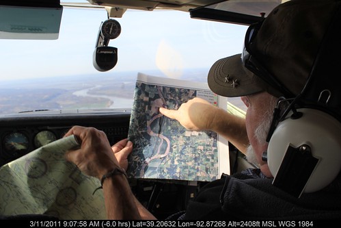 There weren't many surprises in the St. Louis area, he said. One exception was a heap of junk near Howell Island west of the Daniel Boone Bridge that carries Highway 40 between St. Louis and St. Charles counties. That area will be targeted during the cleanup.
The overhead views are of particular help in finding large accumulations of debris that wash into nearby woodlands during flooding and stay when the water recedes, he said. Much of that was found in low-population areas in western Missouri, such as near the mouth of the Grand River near Brunswick.
"There must have been 10 acres of driftwood and trash, including refrigerators and 55-gallon drums," said Barrow, who took part in the survey.
He said various riverside dump sites obscured by vegetation also were pinpointed, including one near New Haven in Franklin County.
The survey was conducted March 11-12 with GPS-synchronized cameras in a six-seat Cessna run by Colorado-based EcoFlight, which does aerial scouting for various environmental causes.
This year's cleanup campaign, called the Big Muddy Clean Sweep, has another twist.
For the first time, the organization has chartered a barge to cruise the length of the river and serve as the common receptacle for trash picked up in various drives along the way.
The trash will then be taken to a terminal for transfer to landfills or recycled. In the past, trash from each local drive was disposed of separately.
"This will be a lot more efficient," Barrow said.
He added that "it makes a powerful visual statement when people see that barge with a mountain of trash."
This year's effort begins Sept. 10 in Kansas City. Three of the stops and local cleanups will be in the St. Louis area — at Washington, Mo., Oct. 15, St. Charles on Oct. 22 and around the confluence with the Mississippi River on Oct. 29.
The confluence area also will be the subject of a trash collection campaign this Saturday overseen by another group, the Confluence Partnership, and involving Missouri River Relief and other organizations. That event is called the Confluence Trash Bash. For more information, go to confluencegreenway.org.
Originally published in the St. Louis Post-Dispatch on March 23, 2011
Click here for original post
by Mark Schlinkmann
To prepare for its 10th annual Missouri River cleanup later this year, an environmental group recently launched its first aerial mapping survey of most of the 380 miles of the river from Kansas City to St. Louis.
"We saw a lot of trash accumulation we were not able to see" in past surveys by boat, said Jeff Barrow, director of Columbia, Mo.-based Missouri River Relief. "The photos will give us a plan on how to approach it."
The overhead views are of particular help in finding large accumulations of debris that wash into nearby woodlands during flooding and stay when the water recedes, he said. Much of that was found in low-population areas in western Missouri, such as near the mouth of the Grand River near Brunswick.
"There must have been 10 acres of driftwood and trash, including refrigerators and 55-gallon drums," said Barrow, who took part in the survey.
He said various riverside dump sites obscured by vegetation also were pinpointed, including one near New Haven in Franklin County.
The survey was conducted March 11-12 with GPS-synchronized cameras in a six-seat Cessna run by Colorado-based EcoFlight, which does aerial scouting for various environmental causes.
This year's cleanup campaign, called the Big Muddy Clean Sweep, has another twist.
For the first time, the organization has chartered a barge to cruise the length of the river and serve as the common receptacle for trash picked up in various drives along the way.
The trash will then be taken to a terminal for transfer to landfills or recycled. In the past, trash from each local drive was disposed of separately.
"This will be a lot more efficient," Barrow said.
He added that "it makes a powerful visual statement when people see that barge with a mountain of trash."
This year's effort begins Sept. 10 in Kansas City. Three of the stops and local cleanups will be in the St. Louis area — at Washington, Mo., Oct. 15, St. Charles on Oct. 22 and around the confluence with the Mississippi River on Oct. 29.
The confluence area also will be the subject of a trash collection campaign this Saturday overseen by another group, the Confluence Partnership, and involving Missouri River Relief and other organizations. That event is called the Confluence Trash Bash. For more information, go to confluencegreenway.org.
Monday, March 21, 2011
Missouri River pedestrian bridge will open April 8 in Jefferson City
Originally published on March 17, 2011 on KRCG 13
Click here for original link.
by Lucas Bond.
JEFFERSON CITY, MO -- The pedestrian bridge along the Missouri River Bridge is almost done.
MoDOT said the bridge will open to the public April 8th.
The new bridge was designed to help bikers and walkers get to and from the Katy Trail without dodging traffic.
"The job is suppose to go to April 1st. The contractor is on schedule at this point,” MoDOT Charles Sullivan said. “He is going to be granted a few days here and there because the extra piling we put in the ground, and some over runs on the contract allow him a few days."
Sullivan said people have told him they don't like the old pedestrian walkway because they feel it's dangerous.
"The catch is right now it's accessible by car because there is no barrier between cars and pedestrians and bicyclists,” Sullivan said. “The new bridge is going to add a big safety feature of separating pedestrians, bicyclists, or anybody in a wheel chair away from traffic."
Sullivan said the pedestrian bridge cost a little more than the estimated cost of $6.9 million."
Subscribe to:
Posts (Atom)