Showing posts with label US Army Corps of Engineers. Show all posts

Friday, July 29, 2011

Corps releases flood drawdown schedule for fall

Friday morning, July 29, 2011, the Corps of Engineers Omaha District released its plan for reservoir releases through the fall. Links to full information and the text of their press releases are below.

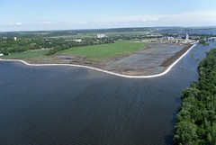
In a nutshell, releases from Gavin's Point Dam will drop to 150,000 cfs by Monday, then hold there through mid-August. They say this is needed to provide maximum evacuation of flood storage before the drawdown. Starting in mid-August, releases will drop 5,000 cfs per day, reaching a goal of 90,000 by August 27. Releases will hold there for approximately two weeks for the Corps to check for damage in dam structures and levees. The stepped drawdown is designed to allow floodwaters to drain slowly from the floodplain, causing less damage to levees as it exits. In addition, the goal is that as waters slowly drop, levees will be able to begin drying as hydrologic pressure from the river is released, causing less slumping.

Releases at Garrison and Oahe are scheduled to reach 85,000 cfs by August17 & 24 respectively, allowing the river to enter its banks again at Bismarck and Pierre.

In mid-September, releases will step down to a goal of 40,000 cfs by October 1. Releases will hold here and eventually will be drawn down to 20,000 cfs. by Dec. 1. Here's a graph of the Gavin's Plan, followed by the plan for upstream reservoirs.


(graphs supplied by US Army Corps of Engineers, Omaha District)

This plan is designed to have the reservoirs out of the exclusive pool as soon as possible and begin getting citizens back into their homes and businesses to begin recovery as soon as possible. 

The Corps plans do not involve providing for additional flood storage space next year. As Gen. McMahon explains in the second release reprinted below, the decision was made to time releases to both evacuate the exclusive flood control storage as soon as possible, then begin lowering levels to allow residents, farmers and communities the most time before winter to rebuild, clean up and assess damages.

Links on 2011 Floodwater Evacuation Plan
Here are the two press releases reprinted from today's announcement. First is the general press release, followed by a more detailed explanation from Brig. Gen. John McMahon.

U.S. ARMY CORPS OF ENGINEERS
NEWS RELEASE
U.S. Army Corps of Engineers – Northwestern Division, 1616 Capitol Ave., Omaha, Neb. 68102
For Immediate Release: July 29, 2011


Corps announces strategy for evacuating floodwaters
Omaha, Neb. - The U.S. Army Corps of Engineers announces its strategy for evacuating floodwaters from its six mainstem dams along the Missouri River today.

“This plan allows the Corps to evacuate flood water from the reservoir system in a responsible way to prepare for the 2012 runoff season, while reducing the risk of further damages and gets affected homeowners, farmers and businesses back on their properties to begin repair and recovery as quickly as possible,” said Brig. Gen. John McMahon, Northwestern Division commander.

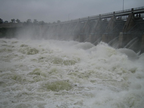
The Corps will execute a gradual drawdown, in which releases out of Gavins Point Dam, the southernmost reservoir in the system, will decrease to 150,000 cubic feet per second on Aug. 1 and will remain at that rate until approximately Aug. 16 when they will be stepped down 5,000 cfs daily until reaching 90,000 cfs around Aug. 27. The Gavins Point Dam releases will stay at 90,000 cfs for approximately 2 weeks and then will drop 5,000 cfs every two days, until reaching 40,000 cfs, which is slightly above the typical fall release rate, on or about Sept. 30.

Releases from Garrison and Oahe dams are scheduled to reach 85,000 cfs on Aug. 17 and 24, respectively. This is the estimated release to get the water back within the river channel and to begin floodplain drainage along the river at Bismarck, N.D. and Pierre, S.D.

This plan provides the opportunity for the Corps to begin inspection and repair of levees and other critical infrastructure and ensures adequate storage for the 2012 runoff season.

For the corresponding detailed three week release forecast for the other mainstem dams, go to: http://www.nwd-mr.usace.army.mil/rcc/reports/twout.html.

“We meticulously reviewed each of eight drawdown options with technical experts and leadership within the Northwestern Division, Omaha and Kansas City Districts,” said Jody Farhat, chief of Missouri River Basin Water Management Division. “This release schedule puts us in the best position to drawdown the water as quickly and as responsibly as possible, while allowing us time to inspect, assess and repair damages.”
In making the decision, the Corps considered criteria such as the potential impacts to homes, farms and businesses within the floodplain, weather forecasts through 2012, acceptable release rate reductions from the dams, water levels on the temporary and downstream levees, getting the reservoirs out of the exclusive flood control zones, impacts to other critical infrastructure (tributary reservoirs, roads, facilities, etc.) and whether to increase the amount of flood control storage for the 2012 runoff season.

The current 2012 weather forecast predicts a 66.6 percent chance of normal or below normal precipitation, and a 33.3 percent chance of wetter than normal conditions. However, fall 2011 is forecasted to be wetter than normal; both of these predications contributed to the drawdown decision. Further consideration was given to the low probability of the re-occurrence of this 2011 500-year event again in 2012.

Holding releases from Gavins Point steady at 150,000 cfs starting through mid-August will enable Fort Peck, Garrison and Oahe Dams to move out of exclusive flood control storage around Aug. 6 while Fort Randall will reach this zone around Aug. 12. This will provide operational flexibility for the Corps to respond if significant rainfall events occur.

The Gavins Point two-week release pause at 90,000 cfs will allow for preliminary inspection and assessment of infrastructure and levees before the final drawdown. Eventually, this steady drawdown from the reservoirs, and respective floodplains, will bring water levels low enough for contractors (weather and funding permitting) to begin repairs as early as Dec. 1.

“It’s important that we drawdown these releases with full consideration of the many risks that remain,” said Brig. Gen. McMahon. “A rapid drawdown with high flows could cause extensive bank erosion and slumping in the levees, while too slow of a drawdown could leave high water on temporary and permanent levees, dams and other critical infrastructure, further increasing risks for overtoppings and breaches.” We assess these risks to be unacceptable in the context of the weather forecast and the low probability of re-occurrence.

“The goal is to evacuate these historic and unprecedented floodwaters responsibly and bring the entire system back to its full annual flood control capacity of 16.3 million acre feet by March 1, which is generally the start of the spring 2012 runoff season,” said Farhat. This will put the flood control pool to a system storage level of 56.8 million acre feet. Prior to the Flood of 2011, and since 1881, this amount has been adequate to capture spring runoff and manage water flow through the system.

“We have already seen water inflows to the system decline and empty system flood control space increase in the past three weeks” said Brig. Gen. McMahon. “We are confident that this plan will best prepare us for the 2012 runoff season.”

All dates provided above are best approximations, based on current forecast conditions and the best available information at the time. Adjustments to the release schedule may be necessary if conditions change. View daily and forecasted reservoir and river information on the Water Management section of the Northwestern Division homepage at: http://www.nwd-mr.usace.army.mil/rcc.

U.S. ARMY CORPS OF ENGINEERS
NEWS RELEASE
U.S. Army Corps of Engineers – Northwestern Division, 1616 Capitol Ave., Omaha, Neb. 68102
For Immediate Release: July 29, 2011


Corps’ drawdown plan aims to be ready for 2012 runoff

- Brig. Gen. John McMahon, Commander Northwestern Division, U.S. Army Corps of Engineers

After much deliberation with my team, I have selected a plan for responsibly evacuating flood waters from the Missouri River Mainstem System through the remainder of 2011. This risk-based decision was not made lightly. We must get the water back into the river banks and out of the floodplain so that people can return to their homes, farms and businesses as soon as possible.

The release schedule selected prepares the basin to be ready for the 2012 runoff season. Our number priority, as always, is public safety. This drawdown schedule is the safest option to evacuate floodwaters from the reservoirs in a timely manner, while simultaneously decreasing the risk to temporary and permanent levees, our six mainstem dams and other critical infrastructure.

We’ve opted to use a gradual drawdown approach. This will provide us with the best chances of minimizing the amount of additional damage we might otherwise face if we attempted to draw down too quickly. The risks associated with too slow a drawdown would leave high water on temporary levees and permanent flood risk reduction structures longer than necessary, which increases our chances of overtopping and/or breaching levees. If we make too rapid a drawdown, we run risks to include potential damage to infrastructure, extensive bank erosion, and sloughing in the levees.

2011 will be the highest runoff season in the Corps’ 113 years of record keeping in the Missouri River Basin. The Mighty “Mo” has reminded us just how unpredictable she can be. This is why it’s so important for us to be prepared for the 2012 runoff season. In light of this year’s runoff, several of the drawdown alternatives considered whether more mainstem system flood control storage is necessary for the 2012 runoff season. None of the options before us could ever eliminate all flood risk. We thoroughly evaluated options of adding an additional 1.3 million acre-feet and 3.6 million acre-feet to the existing 16.3 MAF of flood control storage in the system. These options and others have serious consequences to getting us ready for the 2012 runoff season.

First, the additional time it would take to evacuate any additional volume of water is precious time we don’t have before the onset of cold weather in the Basin. Second, there is unacceptable risk of breaching and/or overtopping additional levees, especially those protecting people and communities; this is due to the prolonged duration of increased releases to accommodate these additional volumes of water through the system. Third, neither the weather forecasts for the remainder of 2011 and for 2012, nor the probability of re-occurrence of this 2011 event in 2012 warrant such additional risk.

The mainstem system was designed based on the 1881 flood. That year, the basin experienced 40 million acre feet of runoff above Sioux City, Iowa, from March to July, the worst flood on record known to modern man. Hence, 16.3 million acre-feet of flood control storage was allocated in the system— which would have been the required amount of storage to manage the 1881 flood waters while keeping system releases at or below 100,000 cubic-feet-per-second. Since the construction of the mainstem system, that amount of storage has been sufficient to adequately handle every runoff season until this year. Runoff from March to July in 2011 is expected to total 49 million acre-feet, 20 percent higher than what the system was designed to manage.

The release schedule does not increase flood control storage prior to the 2012 runoff season. Increasing flood control storage before March 2012 would mean significantly higher releases for a longer period of time this fall. That would further increase the strain on temporary and permanent levees and other critical infrastructure. It would significantly limit our ability to inspect, assess and repair damages because water would be higher longer. Simply put, providing for more flood control storage would gravely jeopardize the basin’s ability to be ready for the 2012 runoff season.

Part of our analysis included weather forecasts through 2012. The forecast predicts a wetter than normal fall 2011. The forecast for a wet fall contributed to our drawdown release decision. Based on the gradual drawdown release schedule, our plan is to decrease releases at Gavins Point Dam to 40,000 cubic feet per second by the end of September. This would give the system the flexibility needed to store additional floodwaters if another significant rainfall event happens this year.

Our evaluation included the consideration of eight drawdown options with a thorough risk analysis of each. We took into account the impacts to homes, farms and businesses within the floodplain, temporary and permanent levees, our dams and other critical infrastructure. The review also took external factors, such as funding, weather and contractor availability, into account. Given our review and assessment of the associated risks, the release schedule we selected was the best option. The plan allows us the time we need to inspect, assess and repair damages. This drawdown schedule provides the best path for the basin to be ready for the 2012 runoff season.

There are limitations and obstacles we must consider as we prepare for the 2012 runoff season. We must quantify and obtain funding to initiate and complete the repairs. We must work closely with contractors to ensure the work is completed safely, on time and within budget. The majority of the work will have to be done during the harsh winter months. The release schedule puts us in a good position to get water levels low enough to begin those inspections and assessments and put contracts in place to begin work as early as 1 December.

We will have to prioritize our efforts based on an applicable set of criteria that puts protection of life and human safety first, followed by protection of key infrastructure and valuable cropland. Given the time constraints, we may not be able to repair everything in time for the 2012 runoff. Those decisions will not be easy.

Meanwhile, a full post-flood assessment will begin soon. The assessment will require us to answer many of the same questions you have been asking us. We will look at how we managed the dams and reservoirs from the winter of 2010 through the end of this flood fight. We will conduct a full-scale assessment to determine what, if anything, needs to change in our operating procedures. All of this will take time.

Our primary objective with this gradual drawdown schedule is to be ready for the 2012 runoff season. To do that, we must evacuate water from the reservoirs and the floodplain in a safe and responsible manner. We are 100 percent committed to this flood fight, and will remain vigilant throughout the coming months as we evacuate this water responsibly, get people back in their homes, farms and businesses, and begin the process of repairing the damage to get ready for 2012.
- Brig. Gen. John McMahon, Commander Northwestern Division, U.S. Army Corps of Engineers

Thursday, July 28, 2011

Corps emails released; drought eases flooding

For the thousands of people affected by this flood who have been wondering how the Corps of Engineers was dealing with water releases as snow piled up this spring, followed by massive rains in the upper basin, the Sioux Falls Argus-Leader opened a window this week. Through a Freedom of Information request, the AL obtained a batch of Corps emails documenting the evolution of this flood. Check out the stories below giving context to this trove of information.

For communities, highway departments and levee districts trying to plan for a fall of repairs, this Friday will provide a guide to future river levels. The Corps is planning on releasing their dam release schedules through September on this Friday, July 29. As always, the forecasts will be subject to change depending on rainfall in the basin. The Corps is planning on reducing Gavin's Point Dam releases from 160,000 cfs to 150,000 from July 31 to August 2. 

Although pulses of rain in the Big Sioux River basin caused new flood crests from Sioux City to Kansas City, the whole lower basin has been spared from the worst case scenario by little to no rain in many parts of the basin. In some counties, farmers in the uplands are suffering the beginning of drought while bottomland farmers are monitoring their levees and constantly pumping out seepwater. At the same time, the continuous massive flows continue to test levees and flood prevention measures throughout the basin.


Argus-Leader series on Corps of Engineers emails
The Sioux Falls Argus-Leader obtained a block of emails from late winter/spring 2011 that give a window into the reservoir releases as weather deteriorated this spring. Includes an analysis story with links to raw emails as well as a timeline created from information in the emails.
Corps of Engineers Aerial Recon Photos
The Corps of Engineers Kansas City District has been releasing aerial recon photos in Google Earth format. If you have Google Earth installed on your computer, you can click the links below to download .kmz files that will open in Google Earth.
Aerial photos posted by Google
Click here to view aerial photos posted by Google of areas near Council Bluffs, IA. 

Editorial/Analysis
Leavenworth Times, July 26, 2011 - "The Missouri River Canal" by Matt Nowak - an idea to send Missouri River water to drier parts of the country. Nothing like a flood to make people forget the drought we just came out of.
St. Louis Post Dispatch, July 22, 2011 - "The Missouri River Compromise" by Robert Kelley Schneiders . You can also check out Schneiders' flood blog by clicking here.

Dakotas
Keloland TV, July 24, 2011 - "No Flood Assistance from FEMA" for individual homeowners.
Yankton Press-Dakotan, July 26, 2011 - "Corps Ready to Reveal Long-term Water Plans" - The Corps will announce release schedule through Sept. on Friday, July 28.
Bismarck Tribune, July 26, 2011 - "Gov. Dalrymple says Corps must give answers" 
Pierre Capital Journal, July 27, 2011 - "State sets up flood camage call center" - in an attempt to appeal FEMA's decision to withhold assistance for individual homeowners, the state is attempting to collect more information on flood damage to present to FEMA. 

Nebraska/Iowa
KTIV Channel 4 - July 27, 2011 - "Missouri River bed drops 6-8 feet" 
Omaha World-Herald, July 25, 2011 - "River dropping after second crest"
Omaha World-Herald, July 27, 2011 - "Plans laid for I-29 reopening" - Waters still have a lot of receding to do, and damage to many areas is unknown, but plans are being made for action after waters drop.
Omaha World-Herald, July 22, 2011 - "Below Flood stage by September?"
WOWT-channel 6, July 24, 2011 - "Aerial Tour of flooding"
WOWT-channel 6, July 25, 2011 - "River Pests out in force" 
Businessweek, July 27, 2011 - "Nebraska nuclear plant's flood recovery being planned" 

Kansas/Missouri 
FOX Channel 4 - July 26, 2011 - "Flooding still threatens Holt County levees"
St. Joseph News-Press, July 27, 2011 - "Casino may not reopen until October"
St. Joseph News-Press, July 24, 2011 - "Trials and tribulations of a long summer" 
St. Joseph News-Press, July 25, 2011 - "Flood insurance policies lead to frustration" 
Columbia Missourian, July 23, 2011 - "Missouri River flooding hurts barge industry"
KSU Collegian, July 24, 2011 - "Kansas River race fills void after Missouri River flooding" 
Columbia Tribune, July 24, 2011 - "Nixon says state ready to help Wooldridge" 
Columbia Tribune, July 24, 2011 - "Corps faces a battle over land near Wilton"

Wednesday, June 29, 2011

Iowa and Nebraska border becomes an inland sea - flood spreads downstream

It's been said over and over...this flood is unlike any other. Because of the dam system, the Corps of Engineers was able to take the top off a monstrous flood and spread it out over time. So now we have a severe to moderate flood for at least two months straight.

In communities closer to the dam, it's guaranteed to be high all summer. The further downstream you go, the continuous flooding will be less severe, but the chance exists with a lot of rain for a really massive flood event on top of it all. In addition to the tens of thousands of acres of flooded farmland and rural towns behind failed levees, the more protected urban areas are in for a constant test and struggle off their defenses and infrastructure. This is going to be one tiring summer.

A major storm Sunday night focused over Northwest Missouri caused a major spike in areas that had been holding steady because of a lack of rain...from the border south. The rains also caused spikes from Sioux City on down. A heavy equipment operator at the Fort Calhoun nuclear plant near Blair, NE, punctured the AquaDam surrounding the plant, causing floodwaters to move up to the building itself and splashing the plant all over national news. According to plant officials, the building itself is watertight for several more feet. Details in stories below.

It's getting tougher to cross the Missouri River as new bridges are closing each day.

Ditch-6 Levee at Hamburg - June 27, 2011
Hamburg, IA, surrounded by temporary levee
Currently, very little rain is forecast in the basin for the next several days, giving a break for communities preparing for bigger water. Levees are breaking like crazy in northern Missouri/Kansas and heading downstream.

Here's an update on some good news coverage throughout the flood zone:

Some News and Information Aggregate Sites
Big Muddy News only publishes updates a couple times a week. We're a good place to check in here and there for a pulse of what's going on. But there are a lot of constantly updated sites you can check out for the absolute latest information. In addition, browse previous postings for other great links. Here's a few:
Missouri River Flood Event and Activities - interactive map of news, flood relief info and volunteer info:http://mightymoriver.crowdmap.com/
On Facebook:
Army Corps of Engineers Omaha District Flood Page - projections, inundation maps, tips on sandbagging, levee knowledge, more
Army Corps of Engineers Kansas City District Flood Page
National Weather Service Missouri River Basin Overview

Aerial Photos and video

Montana
CNN blog, June 24, 2011 - "Waiting for Snowpack to Melt, How Fast and Furious will the Snowpack Gush into the Missouri River?"  According to the Corps of Engineers, the snow above Fort Peck peaked at 141% of normal and is now down to 25% of normal.  The snow in the reach between Fort Peck and Garrison (primarily the Yellowstone basin) peaked at 136% and is now down to 27%.

Dakotas
KSFY-TV - Pierre - "Local official tried to warn Corps of potential flooding in February" - a story about a local man who had been watching snowpack accumulate in National Weather Service data and tried to spread awareness of the possibility of major flooding. This was before the May rains that changed the game. A well done, non-hysterical local news story.
US Army Corps of Engineers - June 28, 2011 - Corps to inspect spillway gates at Big Bend July 1 - The Corps will be shutting down the spillway to check for erosion and stability of structure. They anticipate this will take one day. 
Bismarck Tribune - June 28, 2011 - "Missouri River Scour threatens property, digs deep"  Scouring has created spots along Missouri River 100 feet deep.

Iowa/Nebraska
Omaha World Herald, June 27, 2011 - "Flood test not over for nuke plant"
Omaha World Herald, June 27, 2011 - "NRC chief stays dry at Cooper plant"
Omaha World Herald, June 28, 2011 - "NRC: Nuke disaster risk low" after visiting Fort Calhoun plant
Omaha World Herald, June 29, 2011 - "Bridge stroll a lesson on the river" Teachers use the flood as a teaching tool.
KETC-Channel 7 - Omaha, June 28, 2011 - "Bluffs residents fight flood from below - Water reported in hundreds of basements in city"
Sioux City Journal, June 28, 2011 - "All's quiet in Decatur with bridge closed"
Reuters, June 27, 2011 - "Regulator signs off on threatened Cooper nuclear plant"
Associated Press, June 27, 2011 (video) - "Flood Challenges nuclear plant"

Missouri/Kansas
St. Joseph News-Press, June 27, 2011 - "Flooding Closes Casino"
St. Joseph News-Press, June 28, 2011 - "Officials fight flooding river" Including photos of casino employees cars flooded in parking lot.
St. Joseph News-Press, June 28, 2011 - "As flood closes highway bridge, Atchison residents worry" Atchison, KS, cut off from Missouri.
Kansas City Star, June 27, 2011 - "Information on Flood flows many ways" - Social media helps spread important information along with misinformation.
Kansas City Star, June 28, 2011 - "Businesses get ready for Missouri River flooding"
Columbia Missourian, June 29, 2011 - "Missouri River Flooding Closes one road to Cooper's Landing" Actually both roads are covered right now. Waters should begin dropping this weekend. 
Lake News Online, June 28, 2011 - "Flooding on Missouri Slows down Bagnell Dam operations"

Wednesday, June 15, 2011

150,000 cfs - the long flood fight has just begun

On Tuesday, June 14th, the Corps of Engineers brought releases at Gavin's Point dam up to 150,000 cfs. Releases are expected to stay there until at least mid-August, according to the latest Corps announcements. Rain continues to fall in the upper basin, and rain storms (not extreme) have been moving through the lower basin all week, expected to continue through to the weekend.

Levees and banks, expecially temporary sandbag and earthen levees are now being tested, and will continue to be tested as the summer onslaught continues. Levees have been breached near Hamburg, IA, and in Holt County, MO. Throughout the areas receiving the most intense flooding, the Dakotas, Nebraska and Iowa, it is agricultural land and rural communities that are the most hard hit. Urban areas are generally more protected, but are feeling the effects of road and interstate closures, utility infrastructure flooding, tributary flooding and bank erosion. The aerial photos being posted on the web (some linked below) are stunning.

The further downstream in Missouri you go, the less intense the threat is. Rainfall in tributaries such as the Grand has been less intense than the past several years, giving a cushion to downstream areas. It appears that a baseline for mid-Missouri, for example, is coming in below the Corps estimates. At least for the moment. Large snowmelt is expected in the Platte valley and new releases are being let out of Kansas River basin reservoirs ahead of the major water on the Missouri, and to release pressure on reservoirs such as the Milford Dam. The Corps continues to draw down Truman Lake on the Osage.

Here's some links to check out the latest on flooding:

Facebook 
There are several really good Facebook pages focused on the flood, posting news stories from around the basin as well as information on sandbagging, relief efforts and Corps press releases. Here's a few I've been looking at:
Aerial Photography
Corps Response
Brigadier General McMahon explains how Master Manual guided decisions during winter and spring. Click here.

Montana
Great Falls Tribune, June 13, 2011 - "Fort Peck officials work to stay ahead"

Dakotas
Bismarck Tribune, June 13, 2011 - "Flood Pollution will be minimal, experts say" - the article suggests the large flows should dilute toxins, then describes all of the things that are bound to end up in the river.

Video of canoe trip through flooded Bismarck - Say Anything Blog - June 14, 2011 - Click here.


Sioux Falls Argus Leader - "Residents deal with high water" - touching video of interviews with Dakotans fighting the flood.


Nebraska-Iowa
Hamburg Reporter, June 15, 2011 - "Update: Breach grows; new estimates indicates temporary levee near Hamburg may be topped"


KETV Channel 7, Omaha, constantly updated - Gallery of viewer submitted photos


Sioux City Journal, June 15, 2011 - aerial video tour of Siouxland area 

Keloland TV, June 15, 2011 - "Big Sioux Floods Missouri River Boat Club"
Keloland TV, June 15, 2011 - "Missouri eating away at small river community"

Iowa Public Radio, June 15, 2011 - "Engineer doubts temporary levees will hold back floodwater"

Omaha World-Herald, continuously updated - "County by County map and flood impact updates" - a great at-a-glance resource. 
Omaha World-Herald, June 15, 2011 - "Eppley fights off floodwaters" - the Omaha airport tries to keep floodwaters out.
Omaha World-Herald, June 15, 2011 - "Heineman's worry: Will Levees Hold?"
Omaha World-Herald, June 11, 2011 - "Policyholders get late surprise"

Des Moines Register, June 10, 2011 - "Branstead Chides Corps Missouri River management"

Videos of Hamburg Levee Breach posted by Atchison County Emergency Management. Click here.

Missouri
Kansas City Star, June 12, 2011 - "All hands on deck in St. Joseph" -

St. Joseph News-Press, June 8, 2011 - "Power Plants Prepare for Flooding"


Marshall Democrat-News, June 14, 2011 - "Expected flood of 2011 may be less dramatic, more chronic than 1993"


KRCG 13 TV, June 14, 2011 - "Mid-Missouri officials prepare for Missouri River flooding"

St. Louis Post Dispatch, June 15, 2011 - "Senator Blunt blames Missouri River flooding on 'faulty plan'" and then proceeds to spread more misinformation blaming endangered species. Unbelievably, he claims the Corps was holding water for their "Spring Rise" plan. Hopefully as this event proceeds, our policy makers will eventually be educated on the reality of the Missouri River.
St. Louis Post Dispatch, June 13, 2011 - "Army Corps of Engineers defends handling of Missouri River"
St. Louis Post Dispatch, June15, 2011 - "Flooding not expected to be heavy in St. Louis area, Corps says"

Friday, June 3, 2011

Editorial: Flood blog by author of "Unruly River"

For folks trying to understand the history and changes of the Missouri River, you can't do much better than reading "Unruly River" by Robert Kelley Schneiders.

Right now Dr. Schneiders is in the Dakotas now and is travelling along reporting on the flood as it happens throughout the basin. You can follow his observations at: http://ecointheknow.com/news/  .

Here's one of his pieces published June 3, 2011 in the Omaha World-Herald, reprinted with the author's permission. As always, the opinion pieces reprinted on Big Muddy News reflect the opinions of the author alone. They are important for gaining perspective on a complex issue.

Midlands Voices: Rethink flood role of Corps

By Robert Kelley Schneiders, Ph.D.

The writer, of Boulder, Colo., has written two books on the history of the Missouri River, “Unruly River: Two Centuries of Change Along the Missouri” (University Press of Kansas, 1999) and “Big Sky Rivers: The Yellowstone and Upper Missouri” (University Press of Kansas, 2003). He is the co-founder and director of Eco InTheKnow, LLC, www.ecointheknow.com.

Wednesday, June 1, 2011

Some 2011 Flood Resources

Just wanted to get a few links out there, where you can find more information relevant to your location along the Missouri River. Many of the prediction products will be updated, so check back in to the District Flood pages to find updates.

U.S. Army Corps of Engineers, Omaha District Flood Resource Page - they handle the reservoir releases and the Missouri River from North Dakota to Rulo, NE - http://www.nwo.usace.army.mil/html/op-e/flood.html


U.S. Army Corps of Engineers, Kansas City District Flood Resource Page - they handle the Missouri River from Rulo, NE, to Hermann, MO - http://www.nwk.usace.army.mil/Flood/index.cfm
National Weather Service Advanced Hydrological Prediction: http://water.weather.gov//ahps2/glance.php?wfo=eax&gage=kcdm7&riverid=203276&view=1,1,1,1,1,1
Check the boxes of the river gages you want to view on the left, click the info you want to view on the right, then click "Make my River Page" on the bottom. This only takes into account 24 hours advanced precipitation, but will have the reservoir releases built in to its prediction.

Sunday, May 29, 2011

Corps updates reservoir release forecast to unprecedented levels

On Saturday evening, May 28, the Corps of Engineers updated reservoir release projections again. The previous record release from Gavin's Point Dam was 70,000 cfs in 1997. Projected releases by mid-June have been increased to 150,000 cfs.

Press Releases from the US Army Corps Omaha District can be accessed on their website here: http://www.nwo.usace.army.mil/html/pa/pahm/newsreleases2011.htm

Here's the Corps release:

Omaha, Neb. – Rapidly changing weather conditions in Montana, northern Wyoming and the western Dakotas have prompted the U.S. Army Corps of Engineers to make adjustments to previously announced releases. Future releases will reach record levels considerably higher than those previously announced.

Releases from the Missouri River reservoirs, already at historic levels, will be increased again due to higher than forecast rains in North Dakota yesterday. Record flows and flooding are the result of above-normal snowpack and extraordinary rain events during the last several weeks. Significant flooding in cities, towns and agricultural land is expected in North and South Dakota with many areas from Sioux City, Iowa, to the Mississippi rising above flood stage.

Flows from five of the six dams are expected to reach a record 150,000 cfs by no later than mid-June. The previous record releases took place in the fall of 1997 at Gavins Point Dam in Yankton, S.D.

“Protecting lives is our number one priority right now,” said Brig. Gen. John McMahon, Commander of the Northwestern Division of the Army Corps of Engineers. “We are working closely with state and local emergency management teams to identify potential flood areas, provide residents with the most current information and help protect vital public infrastructure.”

People living along the river are encouraged to make evacuation plans to protect their possessions and property. Maps for potential flood areas can be found at: www.nwo.usace.army.mil. Residents in communities along the river are encouraged to contact their local emergency management offices for additional details.

Flooded areas are expected to be inundated for several months.

“Moving water out of the reservoirs is essential,” said General McMahon. “Our release plan is based on the rain we’ve already received and that which is forecast for this weekend and the snow melt forecast. More heavy rain storms could cause major revisions.”

“Due to our vigilant dam safety program, all dams are well prepared to handle the onslaught of floodwaters,” said McMahon. “This is what these reservoirs were designed to do. They are inspected and maintained on rigid schedules. Our dams are sound.”

In the last month, portions of the upper basin have received a year’s worth of rain. “The amount of rain has nearly filled the reservoirs, doing away with the flexibility we had built into our operations for this year,” said Jody Farhat, Chief of the Water Management Division here. “With the arrival of the 140 percent-of-normal snowpack runoff, all the reservoirs will reach their maximum levels, and two will use surcharge storage requiring the operation of the spillways.” Surcharge storage is storage in excess of the exclusive flood control pool. The exclusive flood control pool is the area of the reservoir designed exclusively for the storage of floodwaters.

“Our initial release plans were based on rains already received as well as what’s in the forecast for snowmelt,” said Farhat. “The continuous heavy rains we’re experiencing throughout the basin have dramatically altered our release plans and if we continue to receive heavy rains like this, major revisions in the plan will be necessary.”

Releases out of Fort Peck, Mont., will start to step up next week and are expected to reach 50,000 cfs by June 6. The reservoir will use several feet of surcharge storage above the exclusive flood control pool as the spillway gates are raised.

Garrison releases will increase from the current 80,000 cfs to 85,000 cfs on Monday and Tuesday, and will quickly be stepped up to 120,000 in early June. Releases are scheduled to reach 150,000 cfs no later than mid-June. The reservoir will utilize several feet of surcharge storage above the exclusive flood control pool as the spillway gates are raised. For the first time in history, the spillway gates will be used to pass floodwaters at Garrison Reservoir.

Oahe releases will be maintained at the 85,000 cfs rate through June 2 and then quickly stepped up to 130,000 cfs during the first week of June. Releases are scheduled to peak at 150,000 cfs no later than mid-June. The reservoir will peak within a foot of the top of the spillway gates at 1619 feet.

Big Bend releases will mirror those from Oahe, with its reservoir remaining essentially level at 1420 feet.

Releases from Fort Randall will gradually increase from the current 67,000 cfs to 100,000 cfs during the first week of June. Releases are scheduled to peak at 148,000 cfs no later than mid-June.

Releases from Gavins Point will gradually increase from the current 69,000 cfs to 100,000 cfs during the first week of June. Releases are scheduled to peak at 150,000 cfs no later than mid-June.

“State and local emergency management teams will be the point of contact for residents needing information about flooding in their area,” said Kim Thomas, Chief of the Emergency Management Office here. Below are contact Web sites and phone numbers.

State Emergency Contact Numbers

These Web sites and phone numbers are also available on Corps Facebook page (www.facebook.com/OmahaUSACE) under the State, County and Local agencies tab.

* Iowa

* www.iowahomelandsecurity.org

* 515.725.3231

* Montana

* http://dma.mt.gov/des

* 406.324.4777

* Nebraska

* www.nema.ne.gov

* 24-hour operations - 402. 471.7421

* 24-hour emergency - 402.499.1219

* 24-hour emergency - 402.499.1227

* State EOC - 877.297.2368
* North Dakota

* www.nd.gov/des

* 701.328.8100

* 800.773.3259

* South Dakota

* www.breadysd.com

* 605.773.3231

* 877.579.0015

* Wyoming

* http://wyohomelandsecurity.state.wy.us/

* 307.777.4663 (HOME)

Wednesday, April 27, 2011

2011 looking to be "one of the wettest on record"

Originally published in the St. Joseph News-Press on April 26, 2011
Click here for original link. 
By Marshall White

The U.S. Army Corps of Engineers has changed its cautiously optimistic February forecast.

“2011 is lining up to be one of the wettest years on record,” said Jody Farhat, chief of the Missouri River water basin management.

Despite the fact all of last year’s 9.1 million acre feet of floodwaters were evacuated from the dams, the corps already has 8 million acre feet stored from the 2011 plains’ snowpack. And the mountain snowpack is 130 percent of normal and still rising, Mrs. Farhat said.

Monday, April 25, 2011

Missouri River Flooding Reports from the Web

Published April 25, 2011.

blogmaster's note: Here's several links related to current flooding on the lower Missouri River (below Gavin's Point Dam). I'll keep posting stories here for several days as things develop. Luckily, the Missouri River so far has not been hit nearly as hard as the Upper Mississippi, but the potential for flooding exists if there is a lot of rainfall in the basin below Gavin's Point Dam. For now the highest levels are in the Omaha to St. Joseph reach of the river.

First, though, is a link to a couple useful resources from the National Weather Service.
Missouri River Advanced Hydrological Predictions page (select the gages you want to see on the left, select the information you want from that gage on the river, then click "Make My River Page" at the bottom):
http://water.weather.gov//ahps2/glance.php?wfo=eax&gage=kcdm7&riverid=203276&view=1,1,1,1,1,1

Here' is their map overview of the Missouri River Basin, just another way to access the above information:
http://www.crh.noaa.gov/mbrfc/?n=RFC_observed

News Stories:
Missouri River Flooding Threatens Iowa and Nebraska - Action 3 News - Omaha (April 24, 2011):
http://www.action3news.com/story/14505545/missouri-river-threatens-iowa-and-nebraska

Missouri River Running High: Plattsmouth Project Delayed - Channel 6 WOWT - Omaha (April 19, 2011):
http://www.wowt.com/news/headlines/Missouri_River_Running_120198854.html?ref=854

Corps of Engineers Bumps Up Missouri River Releases Because of Runoff - Sioux City Journal (April 21, 2011):
http://www.siouxcityjournal.com/news/state-and-regional/iowa/article_e4ac6b98-6c35-11e0-afbe-001cc4c002e0.html

Missouri River On the Rise - St. Joseph News-Press (April 22, 2011):
http://www.newspressnow.com/localnews/27644555/detail.html

Wednesday, April 6, 2011

Funds sought for river gauges

Originally published on April 6, 2011 in the Omaha World-Herald
Click here for original link.
By Nancy Gaarder

Blogmaster's Note: These cuts are not restricted to Nebraska and Iowa, but include Missouri and Kansas as well. There is a meeting in Council Bluffs about the proposed cuts: Thursday, 1 p.m. to 4 p.m., Iowa National Guard Armory, 2415 E. Kanesville Blvd., Council Bluffs

The number of Missouri River gauges in Nebraska and Iowa could be reduced under an Obama administration budget proposal.

The gauges are important to such things as flood forecasting, electric power generation and municipal water supplies.

But because so few barges ply the Missouri River, the gauges aren't as important to their original purpose — navigation. This is why some are at risk of being shut down.

To avoid that possibility, the two federal agencies responsible for the gauges are appealing to communities, states, utilities and others to consider setting aside money to cover any lost federal dollars.

The Army Corps of Engineers and U.S. Geological Survey will host a public meeting Thursday in Council Bluffs to discuss the river gauges.

“We want to lay it all on the line and say, ‘Here's what we're looking at,' so that they have more time to see if they can scrape up the funding,” said Greg Nalley, data chief for the U.S. Geological Survey in Iowa.

Nalley said the Geological Survey and Corps of Engineers have a history of working with local governments on funding for gauges. Each gauge costs about $14,900 a year to operate, he said.

That hasn't kept all gauges operating, however. Nalley said Iowa has 18 gauges along the Missouri River and its tributaries, but at one time had about 26.

Tim Temeyer of the Corps of Engineers in Omaha said the gauges are funded through a portion of the Corps budget that pays for bank stabilization and navigation on the Missouri River.

Temeyer, chief of the water control and water quality section of the Omaha corps, said the agency is proposing to set priorities by making cuts based on a program's purpose.

Because the Missouri River sees relatively few barges, proportionately more gauges would be cut along the Missouri River than along a river with significant barge travel, such as the Mississippi or Ohio.

Like Nalley, Temeyer said the goal of the Thursday meeting is to get ahead of any potential cuts.

As it stands now, no one knows what will happen with next year's federal budget, he said. However, the budget year starts in October, so it's possible that funding for gauges could be lost as early as this fall.

As currently proposed, the Missouri River program could see a 40 percent cut, said Dick Taylor, operations program manager for the corps.

The cuts would also affect gauges in the State of Missouri.

Bob Swanson, director of the Geological Survey's Nebraska Water Science Center, said the gauges are important on both sides of the river.

“As these gauges get dropped, they're very hard to replace,” he said.

Swanson said he is hopeful that others agencies will step up.

Monday, April 4, 2011

Mo. River Priorities Questioned At Meeting

Originally published in Yankton Press-Dakotan on April 2, 2011
Click here for original link
by Randy Dockendorf

blogmaster's note - This meeting was one of a series of public comment meetings about the Draft Scoping Summary of the Missouri River Authorized Purposes Study (MRAPS). Check out MRAPS website here: http://mraps.org/ . You can download the draft summary by clicking here.
Remaining meetings:
Apr 4 Nebraska City, NE Lied Lodge Conference Center, 2700 Sylvan Rd.
Apr 5 Kansas City, KS Hilton Garden Inn, 520 Minnesota Ave.
Apr 6 St. Louis, MO Doubletree Hotel St. Louis at Westport, 1973 Craigshire Rd.


SIOUX CITY, Iowa — Bill Smith questions the current priorities for the millions of dollars spent each year on operating the Missouri River.

“The Corps of Engineers receives $6.5 million annually to manage the river for us, and then you multiply it by 67 years (since passage of the 1944 Flood Control Act),” the Sioux City man said.

Smith thinks upstream states could gain much greater attention — and resources — with the Missouri River Authorized Purposes Study (MRAPS) under way. Congress directed the Corps of Engineers to conduct the study of Missouri River usage.

However, Smith — the president of the Missouri Valley Waterfowlers Association — sees navigation interests and other parties fighting to block any changes in the river’s uses.

Smith pressed for the study during this week’s MRAPS public feedback meeting in Sioux City. He blasted those who are fighting a change of river priorities or blocking the discovery of new priorities altogether.

“They just want to protect the status quo. They don’t want the study to reveal anything new,” he said. “Special entities are keeping this low key. If the public knew more information, they would come unglued.”

Wednesday, March 23, 2011

North Dakota: Legislature Urges Army Corps of Engineers to Give the State Back Water Control

Originally published in PlainsDaily.com on March 22, 2011
Click here for original link
By Kate Bommarito

The Senate passed HCR 3019 today, a resolution urging the Army Corps of Engineers (COE) “to immediately cease wrongful denial of access and wrongful requirement of payment for the natural flows of the Missouri River,” and demands that the COE “forgo any attempt to charge water users in North Dakota a fee to use water from Lake Sakakawea or Lake Oahe.”

Both the Governor and the Attorney General had testified at the resolution’s committee hearing.  At the House hearing, Dalrymple called the US Army Corps of Engineers’ new policies both “unjustifiable” and “utterly inappropriate for the state of North Dakota.”

The Corps has had a long and contentious history when it comes to their management of the Missouri River water.  Most recently, the COE has been attempting to charge North Dakota water “storage fees,” for water held in Lake Sakakwea and Lake Oahe.

State Attorney General Wayne Stenehjem stated “It is not just nor I think legal to demand that we get permission to use water that naturally flows through our state, and it borders on insult to demand that we pay for it,” when he addressed the House Energy and Natural Resources Committee.

At the same time the Senate was voting on HCR 3019, the House was voting on a related resolution, SCR 4002, urging Congress “to provide a legal process to return to the state of North Dakota land controlled by the Army Corps of Engineers which is not necessary for authorized purposes.”

SCR 4002 specifies that the COE “has acquired certain lands around the Missouri River water system, including Lake Oahe and Lake Sakakawea,” and demands that the land be returned, giving the state of North Dakota full control over the land, including access to the river’s water.

The Corps’ plan to charge the state for its water has been met with public outcry in the state and has far reaching implications, especially considering the current water pipeline projects and the oil industry’s increased need for access to water.

Both resolutions passed their respective chambers unanimously

Tuesday, March 8, 2011

MRAPs releases Draft Scoping Summary

The Missouri River Authorized Purposes Study run by the US Army Corps of Engineers has released its Draft Scoping Summary. It's a 347 page document distilling the hundreds of public comments received last year during the first phase of the study.

Now MRAPs is moving into a public comment period on the Scoping Summary. Several meetings have been scheduled throughout the basin for public comment.


Click here for more information. 

Click here to download the draft Scoping Summary (5.8 MB pdf)

Monday, February 28, 2011

Missouri River Levees Discussed

by Marshall White
Originally published February 27, 2011 
in the St. Joseph News-Press
Original Link: http://www.newspressnow.com/localnews/27019222/detail.html

COLUMBIA, Mo. — Spring is three weeks away, but it’s not too early to start worrying about flooding on the Missouri River.

Recent warm weather caused a spate of draining from the plains snow pack and moved river ice out of the system.

That was a good thing, said Jody Farhat, the Army Corps of Engineers Missouri River water management chief.

“Essentially, full flood storage capacity is available,” she told members of the Missouri Levee and Drainage District Association.

State officials and area farmers have their doubts.

Missouri has requested that navigation season open early in part because there is a high likelihood of floods, said Sara Pauley, Missouri Department of Natural Resources director.

Last year’s flooding left many levees in poor condition, and the National Weather Service is predicting a wet spring.

The result could be more flooding, said Mike Wells, a Missouri River specialist with DNR.

The Corps of Engineers planned two spring pulses this year to increase Missouri River flow.

“I’m betting we won’t do the March pulse,” Mrs. Farhat, the official with her hand on the spigot, said.

The Corps of Engineers increases the water flow to assist the pallid sturgeon, but a recent study shows that the fish doesn’t need a pulse, Ms. Pauley said.

“Science now knows that the sturgeon’s spawning cues are increased daylight and water temperature, not a river pulse,” she said.

A spring rise could bring high water that would affect bottomland drainage.

If the Missouri River runs above 13 feet, it creates drainage problems for the Halls and Rushville/Sugar Lake levees, said Lanny Frakes, vice president of the association and a local farmer.

Water that isn’t pumped off the land means drowned crops, Mr. Frakes said. The option of pumping becomes more costly with rising fuel costs, he said.

But high fuel costs could be a plus for the river.

That will make people rethink their logistics and could turn the Missouri River back into a marine highway, said Ernie Perry, DNR’s freight development administrator.

Making St. Joseph’s port a success is something Ron Blakley, a member of the local port authority’s board of directors and an area farmer, would like to see.

However, the condition of levees in St. Joseph remains a concern.

The 1993 flood breached the Elwood-Gladden levees and there’s no money in the 2012 fiscal budget to fix the St. Joseph-area levees.

“As a community, we can’t afford to see that time bomb explode because it could mean the loss of the Air National Guard,“ Mr. Blakely said.

The Corps did have some good levee news.

Contracts have been signed to repair the two non-federal Holt County levees that breached in 2010.

Corps releases Environmental Impact Statement on Missouri River Commercial Dredging

The US Army Corps of Engineers has released the Environmental Impact Statement with their suggestions for commercial dredging on the Missouri River in the state of Missouri.

Here's the link to the full report:
http://www.nwk.usace.army.mil/regulatory/Dredging/MO/MOdredging.htm

The Corps is suggesting a 16 percent reduction in material removed from the river, mostly in the Kansas City area. Levels at St. Joseph and Waverly would increase with other locations remaining stable. The reduction is in response to the bed degradation issue in the Kansas City area.

Here's a link to another article about the EIS:
http://bigmuddynews.blogspot.com/2011/02/usace-completes-eis-on-missouri-river.html

Tuesday, February 22, 2011

USACE Completes EIS on Missouri River Commercial Dredging

Originally pubished by Dredging Today
Feb 21st, 2011
Original Link: http://www.dredgingtoday.com/2011/02/21/usace-completes-eis-on-missouri-river-commercial-dredging-usa/

The U.S. Army Corps of Engineers has completed the Final Environmental Impact Statement (EIS) on Missouri River Commercial Dredging. This EIS evaluates the potential impacts of private commercial dredging operations seeking USACE authorization to extract sand and gravel from the Missouri River. The Final EIS identifies the Environmentally Preferred Alternative, which would authorize a level of dredging that USACE believes would best protect the biological and physical environment and minimize the negative socioeconomic impacts on the local and regional economy and the sand and gravel industry.

Saturday, February 19, 2011

MRAPs Draft Scoping Summary and Public Feedback Meetings

(blogmaster's note: Last year the Corps of Engineers held public comment and scoping meetings throughout the Missouri and Lower Mississippi River basin as the first stage in a five-year study revisiting the 8 authorized purposes of the management of the Missouri River. This March, the draft summary of this stage of the study will be released online, followed by more public comment meetings. To check out the public comments submitted last year, click here. One more note - a lot of politicians have stated that this study is a repeat of the Master Manual study completed in 2006. Here's a link to a brochure the Corps published highlighting the differences between the two studies: http://mraps.org/sites/default/files/documents/study_scope_mm_vs_mraps.pdf )
Here's the press release from the Corps of Engineers about upcoming MRAPs activities:
(original link: http://mraps.org/mraps-draft-scoping-summary-report-be-available-online-feedback-meetings-scheduled )

Kansas City, MO - The U.S. Army Corps of Engineers will hold seven public meetings to collect feedback on the Missouri River Authorized Purposes Study (MRAPS) Draft Scoping Summary Report. Throughout the summer of 2010, the Corps received scoping comments to help define the study scope of the MRAPS. Those comments received by Sept. 20, 2010, have been taken into account, analyzed and addressed by the Corps in the Draft Scoping Summary Report. The draft report will be made available for online viewing in March 2011 on www.mraps.org .

Friday, February 11, 2011

Rollin' on the River

Corps of Engineers discuss ‘liquid highway’
by Marshall White
originally published in St. Joseph News-Press - February 9, 2011
original link: http://www.newspressnow.com/localnews/26814051/detail.html

KANSAS CITY — The liquid highway is at St. Joseph’s western doorstep and will be about as good as it can get in 2011.

That was the word from Army Corps of Engineers officials, in Kansas City on Wednesday to meet with navigators, shippers and boaters.

“For Missouri River users, this is as good as it’s going to get,” said John LaRandeau, the corps’ navigation program specialist.

Thursday, January 27, 2011

Corps Studies Niobrara Flooding

Unexpected Rise In Niobrara River Takes Everyone By Surprise
blogmaster's note: The Niobrara River enters the Missouri River upstream of Gavin's Point Dam. Siltation of the Niobrara delta has been an increasing problem since the dam was built, but the high water of the past several years is causing unprecedented flooding.

BY RANDY DOCKENDORF
Published: Thursday, January 27, 2011 in the Yankton Press-Dakotan
Original Link: http://www.yankton.net/articles/2011/01/27/community/doc4d40e96946c0f537461029.txt

NIOBRARA, Neb. — Corps of Engineers officials say they remain baffled on how to stop the flooding of Niobrara’s lower west side that has continued for nearly a week.

Missouri River flooding has shaped the history of the town — it’s been moved twice to higher ground. However, area residents are saying the current flooding is unlike anything they have seen before.

In response to the current Niobrara flooding, the Corps reduced the Missouri River releases, said Dave Becker, operations project manager at the Gavins Point project near Yankton.

“We heard about the problem on Friday, so we lowered our flows out of Fort Randall Dam (at Pickstown) from 18,500 cubic feet per second (cfs) to 17,500 cubic feet per second,” he said.

“After those flows were reduced on Friday, we left them down. We were just trying to get an understanding of what is going on — if there is something we can do, or if it’s a fact of nature and something we can’t control.”

The Corps attributes the problem to Niobrara River siltation that dumps into the Missouri River, Becker said.

“There has been 53 years of sedimentation accumulated at the delta,” he said. “It affects everything, so I’m sure it contributes (to this flooding). The sediment has raised the water levels considerably.”

The sediment has dramatically worsened at the same time that the region has seen historic flooding, Becker said.

“We had major flooding issues in the Niobrara area back in the 1990s, when they had high (Missouri River) flows,” he said. “Then we had the drought period, and we didn’t have as many problems because there wasn’t as much water in the river.

“Now, we are in our third wettest year in 112 years on the Missouri River, and these problems show up as extreme events.”

Most of the Knox County community of 400 now sits on a hill overlooking the Missouri River. However, a portion of the town — including the K-12 school with about 165 students — remains on lower ground.

Niobrara school superintendent Margaret Sandoz said the district continues to monitor the situation. However, the nearby flooding has not disrupted classroom activities or the school calendar, she said.

“The school is not currently in jeopardy, and we are running business as usual,” she said. “However, three of our five ground water test wells are frozen in and around with the floodwater. I am hoping for a solution soon. This isn’t even our typical flood season.”

Corps officials from Yankton and Omaha have inspected and taken readings in and around Niobrara since last Friday, Becker said. What makes the current flooding even more unusual is its winter occurrence, he said.

“We spent four hours up there (Tuesday), and we looked at the ice and sediment on the Missouri and Niobrara rivers,” he said. “We don’t see anything at this point in time that is constricting the flows anywhere and making the water back up. Our guys will take a look at the data and see if they can do something.”

The Corps, along with the Nebraska Game and Parks Commission, met with Niobrarans this week to learn the flooding’s impact on the residents’ everyday lives, Becker said.

“We didn’t come up with easy answers, but we’re going to put our heads together and see if we can come up with some kind of battle plan in the next week,” he said.

Meanwhile, Victor and Ruth Janak can only watch as floodwaters continue to fill their mechanic and service shop after nearly a week. Their shop is located in the lower part of the west side of town, at the junction of Nebraska Highways 12 and 14.

As of Tuesday night, Vic’s Service was filled with 11 inches of water, silt and ice. The water drops down to 5 or 6 inches during the afternoon, giving them hope, only to see the flooding rise back to the original levels.

“We are waiting to see what the Corps decides to do,” Ruth said. “They had a meeting up here (Tuesday), and they are just as puzzled as we are, on what to do with the situation.”

Even amidst the chaos, the Janaks didn’t stop serving the public.

“We had a customer on Sunday who needed a hydraulic hose, and here was Vic working on one for him, even with the water all around us,” Ruth said.

Vic’s work was perhaps a desire to maintain normalcy and conduct business as usual, or it may have been a belief that the flooding was temporary.

But the Janaks quickly realized that they were in for the long haul in a situation they don’t understand. They were informed they weren’t located in a flood plain, but now they are told that their insurance won’t cover their losses.

“We have to deal with the Corps, and we need to go through lawyers,” Ruth said, adding that they are facing an elevation study that would cost $600.

Niobrara village clerk Bob Olson said the siltation has worsened since last summer, particularly during the last month or two.

“I think there are problems with water digging away at the mouth of the (Niobrara) river,” he said. “The water is backing up on the Niobrara and can’t get into the Missouri. They have dropped the Missouri River (during the past week), but it ran high all summer.”

Olson has lived most of his life in Niobrara and hasn’t seen anything like the current flooding, particularly in the current location.

“This situation has never occurred before, not at this level,” he said.

The construction of the Missouri River dams has changed the natural flow of the river, Olson said.

“It used to be, every few years there would be a flood that would scour out the channel and send the silt down to New Orleans,” he said. “But it doesn’t do that anymore, it just stops here (at Niobrara).”

The Corps maintained even higher Missouri River releases about 15 years ago than it does today, Olson said. However, the current releases create a greater impact because the riverbed constantly silts in, he said.

Olson and other Niobrarans look with concern at the upcoming spring thaw and the prospect of even more flooding.

Knox County emergency manager Laura Hintz said she met this week with the Corps of Engineers and the Game and Parks Commission. She also accompanied the National Weather Service during its survey of recording stations.

“Everyone is stymied as to what is causing (this type of flooding). It hasn’t happened in that area before,” she said. “And now the water comes up and ice forms on top of it, but it’s still under snow.”

Hintz continues monitoring local facilities for potential flooding. So far, the water has remained at bay from several sites, she said.

“The city (of Niobrara) has wells down there, but they are not under water,” she said. “We have a building belonging to the Ponca Tribe that has nothing in it. The Nebraska Department of Roads has a state yard. There are grain bins, hay storage and a cement plant. They all have water close to it.”

In addition, Niobrara State Park officials are monitoring the impact of ice and flooding on a trail bridge, Hintz said. And at one point, water was creeping up on Highway 14, which was highly unusual, but has since receded, she added.

The future remains uncertain, Hintz said. “We don’t know what Friday will bring,” she said.

Olson hopes that local residents are spared major flooding in the lower west side of Niobrara. “I hope it turns out for the business people and property in that area, but it’s not good,” he said.

However, the Janaks believe it’s too late to save their 17-year-old business.

“We are both 50. We will be done with our business,” Ruth said. “Who wants to start over at this time in your life?”

Saturday, January 22, 2011

Another North Dakota Missouri River Water Battle

As North Dakota ramps up development of their oil and gas fields, the need for water for hydrofracking and refining is increasing. The Corps of Engineers recently proposed charging oil companies a "storage fee" for use of "surplus" Missouri River reservoir water. The immediate response from North Dakota politicians and citizens was negative. While the fee is described as being for the oil industry, there is a belief that it would later be extended to farmers and other large water users. Plus, the idea of paying the federal government for water in reservoirs that flooded the richest bottom lands in the state doesn't sit well with many North Dakota citizens.

The Public Comment period ended January 17. Here's the original press release from the Corps:
http://mapservice.swc.nd.gov/4dlink9/4dcgi/GetContentPDF/PB-1902/NR121410.pdf

And here's the Draft "Surplus Water" report that listed originally listed the fee:
http://www.nwo.usace.army.mil/html/pd-p/Sakakawea_SWR_Public_Draft.pdf

Here's a couple stories about the controversy. We'll post more as more details emerge and other states (which share the river) respond.

Bismark Tribune: "Corps plans to open tap to oil industry" Dec. 17, 2010
http://www.bismarcktribune.com/news/local/article_f8114b70-0a17-11e0-814e-001cc4c03286.html

Bismark KX - CBS affiliate: "Corps plan brings protests"
http://www.kxnet.com/getArticle.asp?ArticleId=700440

Williston Herald "Officials voice opposition to Corps plan"
http://www.willistonherald.com/articles/2011/01/21/news/doc4d39b4f6e0148149584517.txt

posted by Steve Schnarr, Missouri River Relief