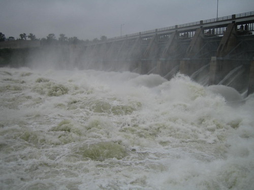
Levees and banks, expecially temporary sandbag and earthen levees are now being tested, and will continue to be tested as the summer onslaught continues. Levees have been breached near Hamburg, IA, and in Holt County, MO. Throughout the areas receiving the most intense flooding, the Dakotas, Nebraska and Iowa, it is agricultural land and rural communities that are the most hard hit. Urban areas are generally more protected, but are feeling the effects of road and interstate closures, utility infrastructure flooding, tributary flooding and bank erosion. The aerial photos being posted on the web (some linked below) are stunning.
The further downstream in Missouri you go, the less intense the threat is. Rainfall in tributaries such as the Grand has been less intense than the past several years, giving a cushion to downstream areas. It appears that a baseline for mid-Missouri, for example, is coming in below the Corps estimates. At least for the moment. Large snowmelt is expected in the Platte valley and new releases are being let out of Kansas River basin reservoirs ahead of the major water on the Missouri, and to release pressure on reservoirs such as the Milford Dam. The Corps continues to draw down Truman Lake on the Osage.
Here's some links to check out the latest on flooding:
There are several really good Facebook pages focused on the flood, posting news stories from around the basin as well as information on sandbagging, relief efforts and Corps press releases. Here's a few I've been looking at:
- Missouri River Flooding 2011 - a good news feed
- 2011 Missouri River Flood - a community page
- Missouri Flood Info - public service page for state of Missouri
- Operation Mighty Mo - the official page of the Missouri River Joint Information Center
- US Army Corps of Engineers - Omaha District
- US Army Corps of Engineers - Kansas City District
- US Army Corps of Engineers - St. Louis District
- Lee County Auctions (private plane - areas near Decatur and Blair) - includes photos of Fort Calhoun Nuclear Plant surrounded by water.
- South Dakota Disaster Recovery photos
- Aerial video of Omaha/Council Bluffs
- Photos posted by Larry Geiger of Omaha to Gavin's.
Brigadier General McMahon explains how Master Manual guided decisions during winter and spring. Click here.
Montana
Great Falls Tribune, June 13, 2011 - "Fort Peck officials work to stay ahead"
Dakotas
Bismarck Tribune, June 13, 2011 - "Flood Pollution will be minimal, experts say" - the article suggests the large flows should dilute toxins, then describes all of the things that are bound to end up in the river.
Video of canoe trip through flooded Bismarck - Say Anything Blog - June 14, 2011 - Click here.
Sioux Falls Argus Leader - "Residents deal with high water" - touching video of interviews with Dakotans fighting the flood.
Nebraska-Iowa
Hamburg Reporter, June 15, 2011 - "Update: Breach grows; new estimates indicates temporary levee near Hamburg may be topped"
KETV Channel 7, Omaha, constantly updated - Gallery of viewer submitted photos
Sioux City Journal, June 15, 2011 - aerial video tour of Siouxland area
Keloland TV, June 15, 2011 - "Big Sioux Floods Missouri River Boat Club"
Keloland TV, June 15, 2011 - "Missouri eating away at small river community"
Iowa Public Radio, June 15, 2011 - "Engineer doubts temporary levees will hold back floodwater"
Omaha World-Herald, continuously updated - "County by County map and flood impact updates" - a great at-a-glance resource.
Omaha World-Herald, June 15, 2011 - "Eppley fights off floodwaters" - the Omaha airport tries to keep floodwaters out.
Omaha World-Herald, June 15, 2011 - "Heineman's worry: Will Levees Hold?"
Omaha World-Herald, June 11, 2011 - "Policyholders get late surprise"
Des Moines Register, June 10, 2011 - "Branstead Chides Corps Missouri River management"
Videos of Hamburg Levee Breach posted by Atchison County Emergency Management. Click here.
Missouri
Kansas City Star, June 12, 2011 - "All hands on deck in St. Joseph" -
St. Joseph News-Press, June 8, 2011 - "Power Plants Prepare for Flooding"
Marshall Democrat-News, June 14, 2011 - "Expected flood of 2011 may be less dramatic, more chronic than 1993"
KRCG 13 TV, June 14, 2011 - "Mid-Missouri officials prepare for Missouri River flooding"
St. Louis Post Dispatch, June 15, 2011 - "Senator Blunt blames Missouri River flooding on 'faulty plan'" and then proceeds to spread more misinformation blaming endangered species. Unbelievably, he claims the Corps was holding water for their "Spring Rise" plan. Hopefully as this event proceeds, our policy makers will eventually be educated on the reality of the Missouri River.
St. Louis Post Dispatch, June 13, 2011 - "Army Corps of Engineers defends handling of Missouri River"
St. Louis Post Dispatch, June15, 2011 - "Flooding not expected to be heavy in St. Louis area, Corps says"
I'm in the Bismarck, ND area. Here's a 2 minute YouTube video taken by a local home owner of the river bank erosion. A tree on the bank, undermined by the fast flow, slips into the Missouri:
ReplyDeletehttp://www.youtube.com/watch?v=RUCMa8V7RCU&feature=youtube_gdata_player
I thought this June 17 blog post from Jeff Masters, PhD, of weatherunderground.com is extremely interesting:
'The flow rates are now a massive 150,000 cubic feet per second, 1.5 times greater than the typical flow of Niagara Falls.' Sobering...